
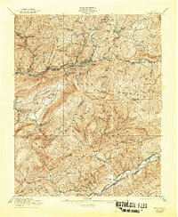
1921 Map of Wise
USGS Topo · Published 1921About this map
The mountain town of Norton serves as a central hub in this survey, where the Norfolk and Western Ry and Louisville and Nashville RR converge. This industrial corridor is defined by numerous mining-era settlements such as Dorchester, Esserville, and Blackwood, which are linked by the Interstate RR through the narrow valleys of Little Stone Mountain. To the south, the terrain rises toward Powell Mountain and High Knob, where the landscape transitions into a more rural pattern of ridge-top schools and creek-side homesteads.
Find a feature on this map
96 named features on this map. Tap any name to fly to it.
Don’t see what you’re looking for? This feature index may not catch every label — zoom into the map to look around manually.
Map Details
Editions of this 1921 Wise Map
2 editions found
Other maps of this area

1886 · Grundy
USGS Topo · 1:125,000

1890 · Whitesburg
USGS Topo · 1:125,000

1890 · Grundy
USGS Topo · 1:125,000

1892 · Grundy
USGS Topo · 1:125,000

1892 · Whitesburg
USGS Topo · 1:125,000

1894 · Estillville
USGS Topo · 1:125,000

1897 · Bristol
USGS Topo · 1:125,000

1902 · Bristol
USGS Topo · 1:125,000

1912 · Pound
USGS Topo · 1:48,000

1913 · Oven Fork
USGS Topo · 1:48,000