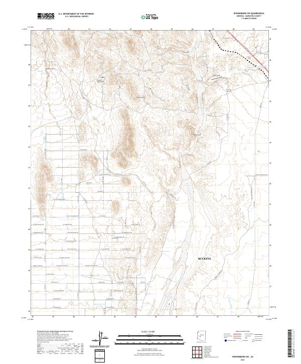
2021 Map of Wickenburg SW
USGS Topo · Published 2021About this map
The Vulture Mountains dominate this Sonoran Desert landscape, characterized by dramatic geology like the Natural Arch and Vulture Arch. The Hassayampa River carves a broad corridor through the center, its drainage network supported by several seasonal channels including Little San Domingo Wash and Daggs Wash. In the southern portion, the area transitions into the northern reaches of Buckeye, where a developing grid of roads such as W Black Mountain Rd and W Carefree Hwy begins to overlay the arid terrain.
Find a feature on this map
66 named features on this map. Tap any name to fly to it.
Don’t see what you’re looking for? This feature index may not catch every label — zoom into the map to look around manually.
Map Details
Editions of this 2021 Wickenburg SW Map
This is the sole edition of this map. No revisions or reprints were ever made.
Other maps of this area

1954 · Phoenix
USGS Topo · 1:250,000

1957 · Phoenix
USGS Topo · 1:250,000

1957 · White Tank Mts. NE
USGS Topo · 1:24,000

1957 · White Tank Mts.
USGS Topo · 1:62,500

1958 · Phoenix
USGS Topo · 1:250,000

1960 · Phoenix
USGS Topo · 1:250,000

1961 · Vulture Mountains
USGS Topo · 1:62,500

1962 · Belmont Mts
USGS Topo · 1:62,500
1964 · Wickenburg
USGS Topo · 1:24,000
1964 · Red Picacho
USGS Topo · 1:24,000