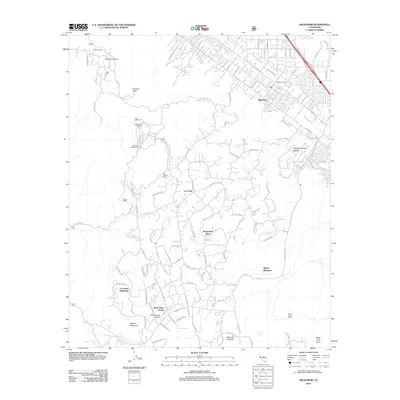
2012 Map of Wildomar
USGS Topo · Published 2012About this map
Wildomar and the surrounding foothill communities are documented here during a period of modern residential expansion along the eastern slopes of the Santa Ana Mountains. The settlement pattern shows a distinct transition from the established community of Wildomar, centered near the Wildomar Cem and post office, to the sprawling rural estates of La Cresta and Sylvan Meadows to the southwest. The landscape is defined by elevated terrain such as Eisinore Peak and Squaw Mountain, with numerous winding roads like Avenida La Cresta and Tenana Rd providing access to high-altitude developments.
Find a feature on this map
116 named features on this map. Tap any name to fly to it.
Don’t see what you’re looking for? This feature index may not catch every label — zoom into the map to look around manually.
Map Details
Editions of this 2012 Wildomar Map
This is the sole edition of this map. No revisions or reprints were ever made.
Other maps of this area

1901 · Southern California Sheet No. 1
USGS Topo · 1:250,000

1901 · Elsinore
USGS Topo · 1:125,000

1901 · San Luis Rey
USGS Topo · 1:125,000

1904 · Southern California Sheet No. 2
USGS Topo · 1:250,000

1904 · Southern California Sheet No. 1
USGS Topo · 1:250,000

1941 · Margarita Peak
USGS Topo · 1:62,500

1942 · Lake Elsinore
USGS Topo · 1:62,500

1942 · Margarita Peak
USGS Topo · 1:62,500

1942 · Temecula
USGS Topo · 1:62,500

1942 · Murrieta
USGS Topo · 1:62,500