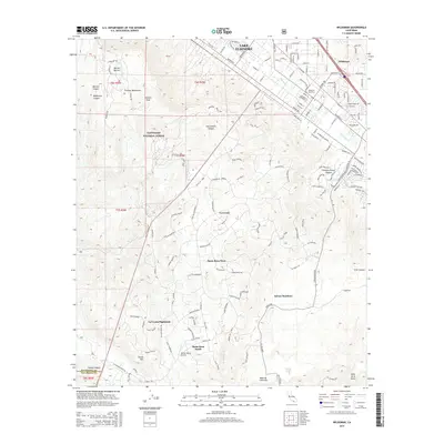
2015 Map of Wildomar
USGS Topo · Published 2015About this map
Wildomar and the upper reaches of the Elsinore Mountains define this 2015 study of the southwestern edge of the Inland Empire. The settlement of Wildomar occupies the northeastern corner, with the Wildomar Cemetery and a dense residential grid transitioning into the dramatic terrain of the Cleveland National Forest. This landscape is marked by prominent high points such as Elsinore Peak and Squaw Mtn, which overlook a series of modern hillside developments including La Cresta, Santa Rosa West, and La Cresta Highlands.
Find a feature on this map
159 named features on this map. Tap any name to fly to it.
Don’t see what you’re looking for? This feature index may not catch every label — zoom into the map to look around manually.
Map Details
Editions of this 2015 Wildomar Map
This is the sole edition of this map. No revisions or reprints were ever made.
Other maps of this area

1901 · Southern California Sheet No. 1
USGS Topo · 1:250,000

1901 · Elsinore
USGS Topo · 1:125,000

1901 · San Luis Rey
USGS Topo · 1:125,000

1904 · Southern California Sheet No. 2
USGS Topo · 1:250,000

1904 · Southern California Sheet No. 1
USGS Topo · 1:250,000

1941 · Margarita Peak
USGS Topo · 1:62,500

1942 · Lake Elsinore
USGS Topo · 1:62,500

1942 · Margarita Peak
USGS Topo · 1:62,500

1942 · Temecula
USGS Topo · 1:62,500

1942 · Murrieta
USGS Topo · 1:62,500