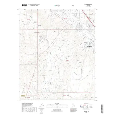
2018 Map of Wildomar
USGS Topo · Published 2018About this map
Cleveland National Forest dominates the western half of this 2018 survey, where the Elsinore Mountains rise to the prominent Elsinore Peak. The transition from these steep canyons, such as Los Alamos Canyon and Morrell Canyon, into the valley floor reveals the urban interface of Wildomar and Murrieta. In the northeast, the residential developments around Lake Elsinore contrast with the rugged, undeveloped expanses of Mesa de Colorado and Mesa de la Punta to the south. The map documents a landscape defined by significant elevation changes, from high peaks down to the Murrieta Creek drainage. Key local landmarks like the Wildomar Cemetery and the Tenaja Valley Airport are captured alongside a dense network of suburban streets and more remote routes like Tenaja Road and the Mortero Trail, illustrating the intersection of modern California growth and protected mountain wilderness.
Find a feature on this map
76 named features on this map. Tap any name to fly to it.
Don’t see what you’re looking for? This feature index may not catch every label — zoom into the map to look around manually.
Map Details
Editions of this 2018 Wildomar Map
This is the sole edition of this map. No revisions or reprints were ever made.
Other maps of this area

1901 · Southern California Sheet No. 1
USGS Topo · 1:250,000

1901 · Elsinore
USGS Topo · 1:125,000

1901 · San Luis Rey
USGS Topo · 1:125,000

1904 · Southern California Sheet No. 2
USGS Topo · 1:250,000

1904 · Southern California Sheet No. 1
USGS Topo · 1:250,000

1941 · Margarita Peak
USGS Topo · 1:62,500

1942 · Lake Elsinore
USGS Topo · 1:62,500

1942 · Margarita Peak
USGS Topo · 1:62,500

1942 · Temecula
USGS Topo · 1:62,500

1942 · Murrieta
USGS Topo · 1:62,500