2023 Map of Wildomar
USGS Topo · Published 2023About this map
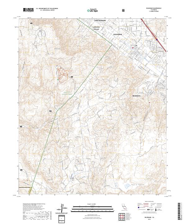
Wildomar and Murrieta sit at the junction of the mountain and valley, where the developed residential grids meet the rising slopes of the Elsinore Mountains. This 2023 survey illustrates the modern layout of the Wildomar community, including the Wildomar Cem and its proximity to the Murrieta Creek drainage. The map reveals a transition from dense street networks along Grand Ave and Clinton Keith Rd to the protected expanse of the Cleveland National Forest and the San Mateo Canyon Wilderness to the west.
Find a feature on this map
97 named features on this map. Tap any name to fly to it.
Don’t see what you’re looking for? This feature index may not catch every label — zoom into the map to look around manually.
Map Details
Editions of this 2023 Wildomar Map
This is the sole edition of this map. No revisions or reprints were ever made.
Other maps of this area

1901 · Southern California Sheet No. 1
USGS Topo · 1:250,000

1901 · Elsinore
USGS Topo · 1:125,000

1901 · San Luis Rey
USGS Topo · 1:125,000

1904 · Southern California Sheet No. 2
USGS Topo · 1:250,000

1904 · Southern California Sheet No. 1
USGS Topo · 1:250,000

1941 · Margarita Peak
USGS Topo · 1:62,500

1942 · Lake Elsinore
USGS Topo · 1:62,500

1942 · Margarita Peak
USGS Topo · 1:62,500

1942 · Temecula
USGS Topo · 1:62,500

1942 · Murrieta
USGS Topo · 1:62,500