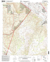
1997 Map of Wildomar
USGS Topo · Published 2000About this map
Wildomar and its surrounding valley floor are shown in a period of suburban transition, bordered by the steep transitions into the Cleveland National Forest and San Mateo Canyon Wilderness. The map delineates the historic land grants of La Laguna Grant and Santa Rosa Grant, grounding the modern landscape in its rancho-era roots. Settlement clusters around established thoroughfares like Grand Ave and Palomar Street, while higher elevations feature rugged landmarks such as Elsinore Peak 3575 and the flat-topped Mesa De Colorado. Researchers will find evidence of rural enterprise at Morrell Ranch and Los Alamos Ranch, alongside recreational and utility features including a Cemetery, an Airport, and the Bear Creek Fire Station. The presence of several Prospects in the Elsinore Mountains hints at the area's mineral exploration history.
Find a feature on this map
34 named features on this map. Tap any name to fly to it.
Don’t see what you’re looking for? This feature index may not catch every label — zoom into the map to look around manually.
Map Details
Editions of this 1997 Wildomar Map
This is the sole edition of this map. No revisions or reprints were ever made.
Other maps of this area

1901 · Southern California Sheet No. 1
USGS Topo · 1:250,000

1901 · Elsinore
USGS Topo · 1:125,000

1901 · San Luis Rey
USGS Topo · 1:125,000

1904 · Southern California Sheet No. 2
USGS Topo · 1:250,000

1904 · Southern California Sheet No. 1
USGS Topo · 1:250,000

1941 · Margarita Peak
USGS Topo · 1:62,500

1942 · Lake Elsinore
USGS Topo · 1:62,500

1942 · Margarita Peak
USGS Topo · 1:62,500

1942 · Temecula
USGS Topo · 1:62,500

1942 · Murrieta
USGS Topo · 1:62,500