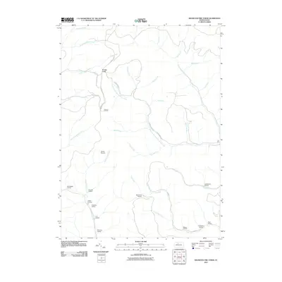
2010 Map of Wildwood Fire Tower
USGS Topo · Published 2010About this map
Wildwood Fire Tower stands as a primary landmark in this densely wooded area of Elk County, overlooking a landscape defined by an intricate network of deep-cut hollows and winding waterways. The small settlement of Straight Creek is situated near the northern edge of the map, where Straight Creek and its branches converge. This territory is characterized by numerous family and industrial-named landmarks, such as Al Wright Hollow, Mason Hollow, and Company Hollow, which suggest the local history of timbering and resource extraction. Significant elevation changes are marked by Jarrets Summit, while the drainage system of the Driftwood Branch Sinnemahoning Creek and the Elk River carves through the terrain. The presence of routes like the Shawmut Gr Rd and Shawmut Grade Rd indicates the area's legacy of mountain transport and forestry access roads.
Find a feature on this map
42 named features on this map. Tap any name to fly to it.
Don’t see what you’re looking for? This feature index may not catch every label — zoom into the map to look around manually.
Map Details
Editions of this 2010 Wildwood Fire Tower Map
This is the sole edition of this map. No revisions or reprints were ever made.
Other maps of this area

1935 · Mt. Jewett
USGS Topo · 1:48,000

1940 · Mt. Jewett
USGS Topo · 1:62,500

1941 · Benezette
USGS Topo · 1:62,500

1941 · Ridgway
USGS Topo · 1:62,500

1943 · Benezette
USGS Topo · 1:62,500

1944 · Ridgway
USGS Topo · 1:62,500

1948 · Crosby
USGS Topo · 1:62,500

1948 · Wildwood Fire Tower
USGS Topo · 1:24,000

1948 · Rich Valley
USGS Topo · 1:24,000

1948 · Norwich
USGS Topo · 1:24,000
Featured Places
- Saint Marys, PA
- Norwich Township, PA
- Straight Creek, Jones Township
- Jones Township, PA
- Shippen Township, PA