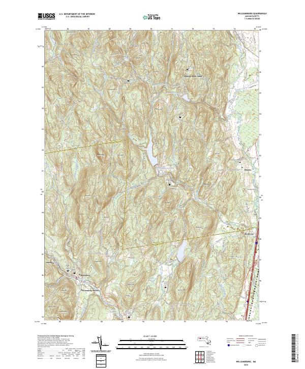
2024 Map of Williamsburg
USGS Topo · Published 2024About this map
Williamsburg and the surrounding hill country of the Franklin and Hampshire border region are defined by a complex drainage network feeding the Mill River. This modern topographic survey illustrates how the industrial past, evidenced by the Brass Millpond and Williamsburg Station, has transitioned into a landscape of water management and recreation. Large water bodies like the Northampton Reservoir and Roaring Brook Reservoir dominate the central valleys, while the Williamsburg/Haydenville Bikeway Trl follows the old transit corridors. Genealogy researchers will find significant value in the numerous burial grounds documented, including the Old Village Hill Cem, Whately Center Cem, and the remote Boyden Cem. The map tracks the steep elevation changes from High Ridge down to the settlement at Whately, showing how modern roads like Conway Rd and Haydenville Rd navigate the same gaps used by early settlers near Searsville and Westbrook.
Find a feature on this map
127 named features on this map. Tap any name to fly to it.
Don’t see what you’re looking for? This feature index may not catch every label — zoom into the map to look around manually.
Map Details
Editions of this 2024 Williamsburg Map
This is the sole edition of this map. No revisions or reprints were ever made.
Other maps of this area

1885 · Northampton
USGS Topo · 1:62,500

1886 · Hawley
USGS Topo · 1:62,500

1886 · Chesterfield
USGS Topo · 1:62,500

1886 · Northampton
USGS Topo · 1:62,500

1888 · Chesterfield
USGS Topo · 1:62,500

1890 · Hawley
USGS Topo · 1:62,500

1890 · Greenfield
USGS Topo · 1:62,500

1891 · Northampton
USGS Topo · 1:62,500

1893 · Northampton
USGS Topo · 1:62,500

1893 · Chesterfield
USGS Topo · 1:62,500