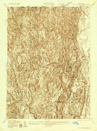
1935 Map of Williamsburg
USGS Topo · Published 1935About this map
Williamsburg and the surrounding villages of Haydenville and West Hatfield define this 1935 landscape at the boundary of Franklin and Hampshire counties. The area is marked by a complex network of water resources and early industrial footprints, including the Northampton Reservoir and Brass Mill Pond. Transport is anchored by the New York New Haven and Hartford railroad, which terminates at the Williamsburg Station, and established routes like State Highway No 116 and Old Goshen Road.
Find a feature on this map
70 named features on this map. Tap any name to fly to it.
Don’t see what you’re looking for? This feature index may not catch every label — zoom into the map to look around manually.
Map Details
Editions of this 1935 Williamsburg Map
This is the sole edition of this map. No revisions or reprints were ever made.
Other maps of this area

1885 · Northampton
USGS Topo · 1:62,500

1886 · Hawley
USGS Topo · 1:62,500

1886 · Chesterfield
USGS Topo · 1:62,500

1886 · Northampton
USGS Topo · 1:62,500

1888 · Chesterfield
USGS Topo · 1:62,500

1890 · Hawley
USGS Topo · 1:62,500

1890 · Greenfield
USGS Topo · 1:62,500

1891 · Northampton
USGS Topo · 1:62,500

1893 · Northampton
USGS Topo · 1:62,500

1893 · Chesterfield
USGS Topo · 1:62,500