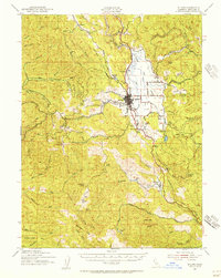
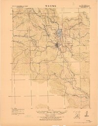
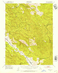
1942 Map of Willits
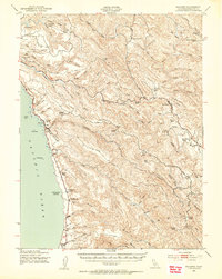
USGS Topo · Published 1956About this map
Willits serves as the central hub of this northern California landscape, situated at the confluence of several vital waterways and the Northwestern Pacific railroad. The map reveals a dense network of family ranching and early 20th-century settlements, including the Ridgewood Ranch to the south and the St Francis Ranch near the marshy expanse of Little Lake. Local education and community life are marked by the Hearst Sch in the northeast near Hearst, while the western terrain transitions into a rugged series of gulches and ridges like Bowman Ridge feeding into the Noyo River.
Find a feature on this map
72 named features on this map. Tap any name to fly to it.
Don’t see what you’re looking for? This feature index may not catch every label — zoom into the map to look around manually.
Map Details
Editions of this 1942 Willits Map
This is the sole edition of this map. No revisions or reprints were ever made.
Other maps of this area

1920 · Glenblair
USGS Topo · 1:62,500

1920 · Ukiah
USGS Topo · 1:62,500

1921 · Branscomb
USGS Topo · 1:62,500
1922 · Willits
USGS Topo · 1:62,500
1929 · Eden Valley
USGS Topo · 1:62,500
1943 · Glenblair
USGS Topo · 1:62,500

1943 · Pomo
USGS Topo · 1:62,500
1943 · Boonville
USGS Topo · 1:62,500
1943 · Navarro
USGS Topo · 1:62,500

1944 · Ukiah
USGS Topo · 1:62,500