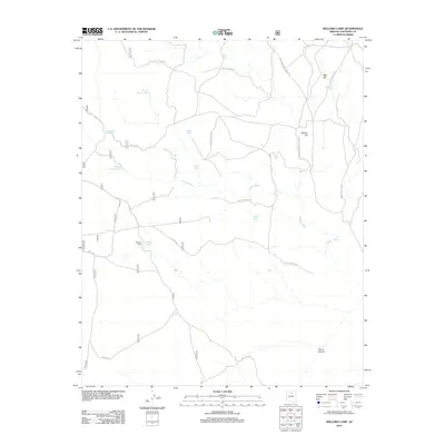
2012 Map of Willows Camp
USGS Topo · Published 2012About this map
Willows Camp and the surrounding high desert of Coconino County are defined here by a network of vital water sources and forest roads. This landscape reflects the essential ranching and resource management infrastructure of northern Arizona, where named stock tanks such as Muggs Castle Tank, Rough House Tank, and Bush Tank provide critical water points across the arid terrain. Drainage for the area is dominated by the winding course of Tappan Wash, which cuts through the central portion of the map. Elevated landmarks like Red Hill and Middle Hill rise above the basin, while Burro Canyon marks the southern reach of the quadrangle. A dense system of fire roads and trails, including Fire Rd 183 and the Gray Mountain Truck Trl, connects these remote sites, showing the modern management of this vast open range.
Find a feature on this map
22 named features on this map. Tap any name to fly to it.
Don’t see what you’re looking for? This feature index may not catch every label — zoom into the map to look around manually.
Map Details
Editions of this 2012 Willows Camp Map
This is the sole edition of this map. No revisions or reprints were ever made.
Other maps of this area

1886 · San Francisco Mtns
USGS Topo · 1:250,000

1891 · San Francisco Mtns
USGS Topo · 1:250,000

1894 · San Francisco Mtns
USGS Topo · 1:250,000

1899 · San Francisco Mtns
USGS Topo · 1:250,000

1947 · Flagstaff
USGS Topo · 1:250,000

1954 · Flagstaff
USGS Topo · 1:250,000

1955 · Coconino Pt SE
USGS Topo · 1:24,000

1955 · Coconino Pt NE
USGS Topo · 1:24,000

1958 · Flagstaff
USGS Topo · 1:250,000

1960 · Flagstaff
USGS Topo · 1:250,000