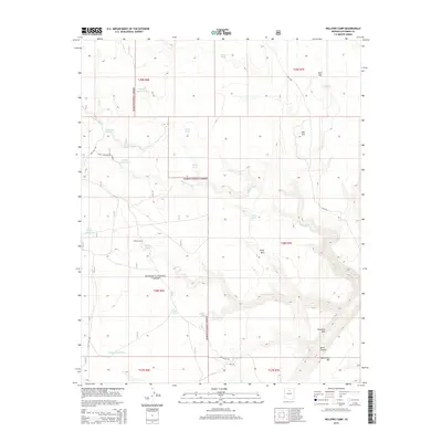
2014 Map of Willows Camp
USGS Topo · Published 2014About this map
Kaibab National Forest dominates this northern Arizona landscape, where the high desert terrain is defined by a sophisticated network of water management features essential for ranching and forest operations. The map highlights numerous specialized water sources, including Willows Tanks, Muggs Castle Tank, and the West Willows Trick-Tank, indicating a land where water is the primary driver of human activity. The settlement at Willows Camp serves as a focal point among these resources, positioned near the seasonal flow of Tappan Wash. To the southeast, the topography becomes more dramatic at the Coconino Rim and Burro Canyon, while isolated peaks like Gray Mtn and Red Hill provide orientation across the vast plateaus. The presence of routes like Crazy Hill Rd and Old 137 Rd trace the movement of forest users and livestock through this high-country environment.
Find a feature on this map
33 named features on this map. Tap any name to fly to it.
Don’t see what you’re looking for? This feature index may not catch every label — zoom into the map to look around manually.
Map Details
Editions of this 2014 Willows Camp Map
This is the sole edition of this map. No revisions or reprints were ever made.
Other maps of this area

1886 · San Francisco Mtns
USGS Topo · 1:250,000

1891 · San Francisco Mtns
USGS Topo · 1:250,000

1894 · San Francisco Mtns
USGS Topo · 1:250,000

1899 · San Francisco Mtns
USGS Topo · 1:250,000

1947 · Flagstaff
USGS Topo · 1:250,000

1954 · Flagstaff
USGS Topo · 1:250,000

1955 · Coconino Pt SE
USGS Topo · 1:24,000

1955 · Coconino Pt NE
USGS Topo · 1:24,000

1958 · Flagstaff
USGS Topo · 1:250,000

1960 · Flagstaff
USGS Topo · 1:250,000