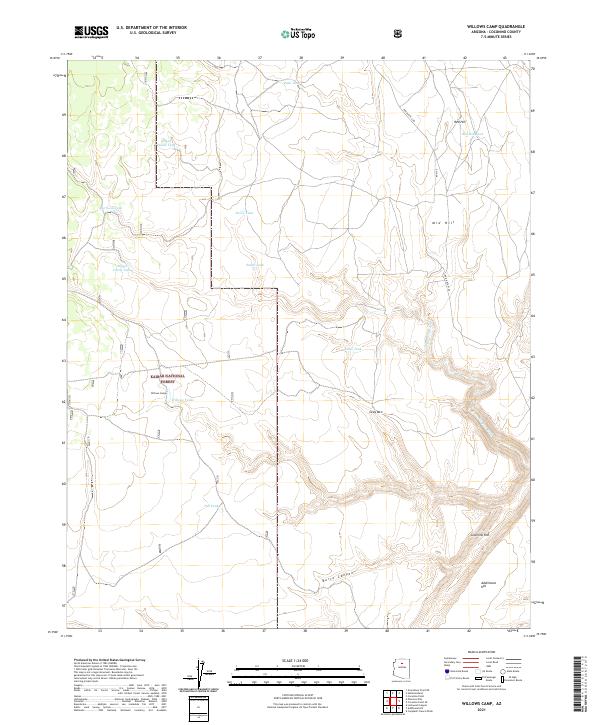
2021 Map of Willows Camp
USGS Topo · Published 2021About this map
Kaibab National Forest dominates this landscape on the Coconino Rim, where the high desert terrain is defined by complex drainage systems and water catchment infrastructure. The namesake settlement of Willows Camp serves as a focal point near Willows Tanks, illustrating the historical importance of water management in this arid region of Arizona. The map details a network of named stock tanks, including Muggs Castle Tank, Bush Tank, and Rough House Tank, which supported ranching operations across the plateau.
Find a feature on this map
27 named features on this map. Tap any name to fly to it.
Don’t see what you’re looking for? This feature index may not catch every label — zoom into the map to look around manually.
Map Details
Editions of this 2021 Willows Camp Map
This is the sole edition of this map. No revisions or reprints were ever made.
Other maps of this area

1886 · San Francisco Mtns
USGS Topo · 1:250,000

1891 · San Francisco Mtns
USGS Topo · 1:250,000

1894 · San Francisco Mtns
USGS Topo · 1:250,000

1899 · San Francisco Mtns
USGS Topo · 1:250,000

1947 · Flagstaff
USGS Topo · 1:250,000

1954 · Flagstaff
USGS Topo · 1:250,000

1955 · Coconino Pt SE
USGS Topo · 1:24,000

1955 · Coconino Pt NE
USGS Topo · 1:24,000

1958 · Flagstaff
USGS Topo · 1:250,000

1960 · Flagstaff
USGS Topo · 1:250,000