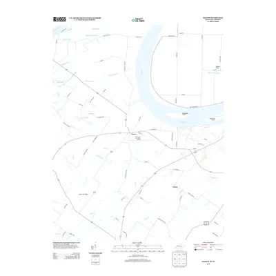
2013 Map of Wilson
USGS Topo · Published 2013About this map
The Ohio River carves a massive bend through this landscape, defining the border between Kentucky and Indiana. Along its banks, complex drainage networks of sloughs and bayous like Big Swan Pond Slough and Pond Bayou reveal the river's historical shifts and the low-lying nature of the bottomlands. Inland, the small settlements of Geneva and Wilson serve as focal points for a rural road network that includes family-named routes such as Clay Cemetery Rd and McDonald Landing Rd. High ground is marked by features like Hickory Ridge and Sugar Tree Ridge, which stand out against the wetland features. The Henderson City-County Airport represents a modern industrial footprint amidst the traditional agrarian and riparian terrain, while Deadmans Island and Henderson Island sit within the main river channel, illustrating the persistent presence of these fluvial landmarks.
Find a feature on this map
66 named features on this map. Tap any name to fly to it.
Don’t see what you’re looking for? This feature index may not catch every label — zoom into the map to look around manually.
Map Details
Editions of this 2013 Wilson Map
This is the sole edition of this map. No revisions or reprints were ever made.
Other maps of this area

1906 · Sebree
USGS Topo · 1:62,500

1907 · Morganfield
USGS Topo · 1:62,500

1914 · Henderson
USGS Topo · 1:48,000

1916 · Henderson
USGS Topo · 1:62,500

1917 · Uniontown
USGS Topo · 1:62,500

1949 · Poole
USGS Topo · 1:24,000

1949 · Robards
USGS Topo · 1:24,000

1951 · Poole
USGS Topo · 1:24,000

1951 · Waverly
USGS Topo · 1:24,000

1951 · Robards
USGS Topo · 1:24,000