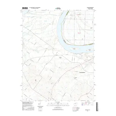
2016 Map of Wilson
USGS Topo · Published 2016About this map
The Ohio River flows through this 2016 survey, defining the border between Indiana and Kentucky near the city of Henderson. The landscape is characterized by complex river systems and low-lying wetlands, featuring numerous named waterways such as Deep Slough, Saurer Slough, and Big Swan Pond Slough. These aquatic features separate elevated landforms like Hickory Ridge and Sugar Tree Ridge, which likely served as critical ground for early settlement and agriculture.
Find a feature on this map
78 named features on this map. Tap any name to fly to it.
Don’t see what you’re looking for? This feature index may not catch every label — zoom into the map to look around manually.
Map Details
Editions of this 2016 Wilson Map
This is the sole edition of this map. No revisions or reprints were ever made.
Other maps of this area

1906 · Sebree
USGS Topo · 1:62,500

1907 · Morganfield
USGS Topo · 1:62,500

1914 · Henderson
USGS Topo · 1:48,000

1916 · Henderson
USGS Topo · 1:62,500

1917 · Uniontown
USGS Topo · 1:62,500

1949 · Poole
USGS Topo · 1:24,000

1949 · Robards
USGS Topo · 1:24,000

1951 · Poole
USGS Topo · 1:24,000

1951 · Waverly
USGS Topo · 1:24,000

1951 · Robards
USGS Topo · 1:24,000