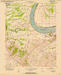
1952 Map of Wilson
USGS Topo · Published 1954About this map
The Ohio River dominates this landscape along the Kentucky-Indiana border, carving a massive bend that defines the local geography. On the Kentucky side, the small settlement of Geneva and the rural community of Wilson sit amongst a network of wetlands and backwaters like Cypress Slough, Swan Pond, and Brushy Bayou. These low-lying areas, punctuated by ridges such as Sugar Tree Ridge and Hickory Ridge, suggest a landscape shaped by the river's seasonal shifts and historic flooding.
Find a feature on this map
43 named features on this map. Tap any name to fly to it.
Don’t see what you’re looking for? This feature index may not catch every label — zoom into the map to look around manually.
Map Details
Editions of this 1952 Wilson Map
This is the sole edition of this map. No revisions or reprints were ever made.
Other maps of this area

1906 · Sebree
USGS Topo · 1:62,500

1907 · Morganfield
USGS Topo · 1:62,500

1914 · Henderson
USGS Topo · 1:48,000

1916 · Henderson
USGS Topo · 1:62,500

1917 · Uniontown
USGS Topo · 1:62,500

1949 · Poole
USGS Topo · 1:24,000

1949 · Robards
USGS Topo · 1:24,000

1951 · Poole
USGS Topo · 1:24,000

1951 · Waverly
USGS Topo · 1:24,000

1951 · Robards
USGS Topo · 1:24,000