Loading...
Loading map...2024 Map of Wilsonville
USGS Topo · Published 2024About this map
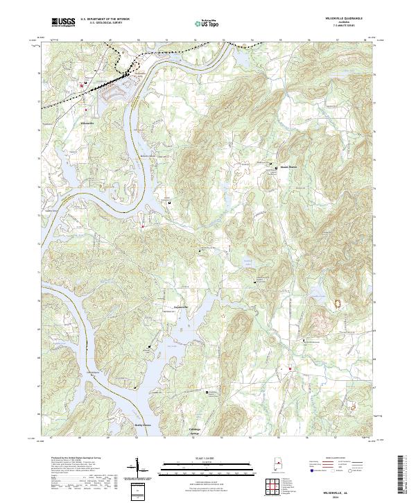
The Coosa River meanders through this landscape, marking the boundary between Shelby Co and Talladega Co. In the northwest, the town of Wilsonville serves as a hub of activity near the CSX Transportation rail line and Yellowleaf Creek. The area is notably dense with historic river crossings, including McGowans Ferry, Owens Ferry, and Fort Williams Ferry, reflecting a reliance on the river for local transport before modern bridge networks became dominant.
Find a feature on this map
136 named features on this map. Tap any name to fly to it.
Don’t see what you’re looking for? This feature index may not catch every label — zoom into the map to look around manually.
Map Details
Date Portrayed2024
Date Published2024
PublisherU.S. Geological Survey
Map TypeTopographic
Scale1:24000
Physical Dimensions24 x 29 inches
Editions of this 2024 Wilsonville Map
This is the sole edition of this map. No revisions or reprints were ever made.
Historical Maps of Mount Sharon Through Time
Featured Locations
Source Details
SourceU.S. Geological Survey
CopyrightPublic Domain