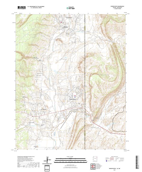
2021 Map of Window Rock
USGS Topo · Published 2021About this map
The administrative heart of the Navajo Nation is captured here along the Arizona and New Mexico border, where the distinct geology of Natural Bridge Canyon and the Chuska Mountains meets the institutional development of Window Rock. The map illustrates a landscape of high-desert mesas and washes, centered on the tribal capital and its surrounding communities. Evidence of regional education and commerce is found at Dine College and the Bonita Trading Post, while geological landmarks like Black Rock Natural Bridge and The Haystacks stand as prominent features of the terrain. The presence of Window Rock Airport and the residential clusters around St. Michaels and Tse Bonito reflect the mid-to-late 20th-century growth of this vital cultural hub. Drainages such as Black Creek and Slick Rock Wash trace the hydrology of the plateau, defining the layout of historical road networks like Indian Rte 12.
Find a feature on this map
78 named features on this map. Tap any name to fly to it.
Don’t see what you’re looking for? This feature index may not catch every label — zoom into the map to look around manually.
Map Details
Editions of this 2021 Window Rock Map
This is the sole edition of this map. No revisions or reprints were ever made.
Historical Maps of Tse Bonito Through Time
Featured Locations
- Fort Defiance Agency
- Eastern Navajo Agency, NM
- Fort Defiance, Fort Defiance Agency
- Bonita Trading Post, Fort Defiance Agency
- Window Rock, Fort Defiance Agency