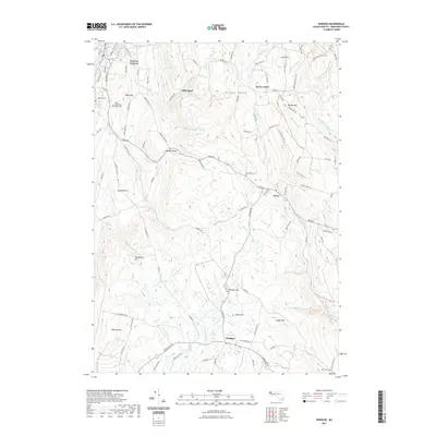
2021 Map of Windsor
USGS Topo · Published 2021About this map
Borden Mtn stands as a prominent high point in the Hoosac Range, anchoring a landscape defined by steep drainages and upland settlements. In the northern reaches, Bowens Corners and Savoy Center mark early nodes of activity, while the aptly named Little Egypt occupies a pocket of high terrain near Patton Brook. The region's complex hydrology is evident in the numerous watercourses feeding the Chickley River and Westfield River, including the dramatic Tannery Falls. Local genealogy is well-supported by several distinct burial sites, including the Bellevue Cem near the town limits and the uniquely named The Tomb Cem situated along the main road. The map traces the winding paths of several trails like the Balanced Rock Trl, which navigate the various hills including Bobs Hill and Hales Hill, showing how the local road network adapted to the challenging Berkshires topography.
Find a feature on this map
117 named features on this map. Tap any name to fly to it.
Don’t see what you’re looking for? This feature index may not catch every label — zoom into the map to look around manually.
Map Details
Editions of this 2021 Windsor Map
This is the sole edition of this map. No revisions or reprints were ever made.
Other maps of this area

1886 · Greylock
USGS Topo · 1:62,500

1886 · Hawley
USGS Topo · 1:62,500

1886 · Chesterfield
USGS Topo · 1:62,500

1886 · Becket
USGS Topo · 1:62,500

1888 · Becket
USGS Topo · 1:62,500

1888 · Chesterfield
USGS Topo · 1:62,500

1890 · Hawley
USGS Topo · 1:62,500

1891 · Greylock
USGS Topo · 1:62,500

1893 · Chesterfield
USGS Topo · 1:62,500

1893 · Becket
USGS Topo · 1:62,500