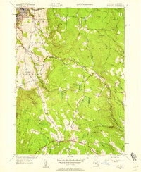
1944 Map of Windsor
USGS Topo · Published 1958About this map
Highland ridges and deep river valleys define this 1940s landscape where the towns of Adams, Savoy, and Windsor meet in the Berkshires. The Appalachian Trail winds through the southwestern corner, crossing over Weston Mountain and passing near Woodchuck Hill. This era shows a network of mountain roads like Savoy Road and Main Road connecting small rural clusters, including Savoy Center and the village of Savoy situated along the Savoy Hollow Brook. The terrain is marked by numerous family-named peaks such as Hales Hill, Borden Mtn, and Judges Hill. Numerous tributaries, including the Chickley River and Westfield River, descend from these heights, illustrating the complex drainage patterns that shaped local industry and early settlement placement in the transition from the industrial valley floors to the agricultural uplands.
Find a feature on this map
49 named features on this map. Tap any name to fly to it.
Don’t see what you’re looking for? This feature index may not catch every label — zoom into the map to look around manually.
Map Details
Editions of this 1944 Windsor Map
This is the sole edition of this map. No revisions or reprints were ever made.
Other maps of this area

1886 · Greylock
USGS Topo · 1:62,500

1886 · Hawley
USGS Topo · 1:62,500

1886 · Chesterfield
USGS Topo · 1:62,500

1886 · Becket
USGS Topo · 1:62,500

1888 · Becket
USGS Topo · 1:62,500

1888 · Chesterfield
USGS Topo · 1:62,500

1890 · Hawley
USGS Topo · 1:62,500

1891 · Greylock
USGS Topo · 1:62,500

1893 · Chesterfield
USGS Topo · 1:62,500

1893 · Becket
USGS Topo · 1:62,500