2021 Map of Winfred
USGS Topo · Published 2021About this map
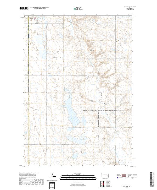
Winfred lies in the northwestern corner of this Lake County landscape, positioned within the distinctive geography of the Coteau des Prairies. This upland plateau, marked by numerous small glacial basins and depressions, is defined by the drainage of the E Fork Vermillion River as it winds southward toward the Miner County line. The settlement pattern is characterized by organized section lines and a scattered distribution of communal and agricultural sites, including the Gracevale Colony and its associated Cem. Significant water bodies like Lake Henry, Lake George, and Lake Winfred anchor the township sections, illustrating the prairie pothole region's natural hydrology. Local history is further preserved at sites like Olson Cem and along the local road network of Co HWY 38 and Co HWY 46.
Find a feature on this map
40 named features on this map. Tap any name to fly to it.
Don’t see what you’re looking for? This feature index may not catch every label — zoom into the map to look around manually.
Map Details
Editions of this 2021 Winfred Map
This is the sole edition of this map. No revisions or reprints were ever made.
Historical Maps of Vermillion Township Through Time
Featured Locations
- Winfred Township, SD
- Clarno Township, SD
- Vermillion Township, SD
- Winfred, Winfred Township
- Gracevale Hutterite Colony, Clarno Township