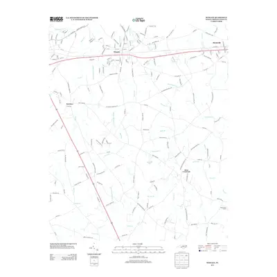
2013 Map of Wingate
USGS Topo · Published 2013About this map
Wingate and Marshville anchor this Union County corridor, where the Piedmont landscape is defined by a dense network of creek branches and farm-to-market roads. The terrain is intricately carved by tributaries like Richardson Cr and Lanes Cr, which drain the agricultural lands between the primary settlements. Smaller community nodes such as Rock Rest and Allens Crossroads indicate the historical pattern of crossroads development typical of rural North Carolina. Local infrastructure is reflected in specialized sites like Brown Field Airport and several rural landmarks such as Braswell Lake. Genealogists and local historians can trace family roots through the placement of rural cemetery access, including Griffin Cemetary Rd, and long-established thoroughfares such as Macedonia Church Rd and Mount Pleasant Ch Rd, which connect the scattered homesteads to the central railway and highway corridor.
Find a feature on this map
162 named features on this map. Tap any name to fly to it.
Don’t see what you’re looking for? This feature index may not catch every label — zoom into the map to look around manually.
Map Details
Editions of this 2013 Wingate Map
This is the sole edition of this map. No revisions or reprints were ever made.
Other maps of this area

1941 · Charlotte
USGS Topo · 1:125,000

1941 · Spartanburg
USGS Topo · 1:250,000

1942 · Charlotte
USGS Topo · 1:125,000

1953 · Spartanburg
USGS Topo · 1:250,000

1953 · Charlotte
USGS Topo · 1:250,000

1954 · Charlotte
USGS Topo · 1:250,000

1960 · Charlotte
USGS Topo · 1:250,000

1960 · Spartanburg
USGS Topo · 1:250,000

1962 · Charlotte
USGS Topo · 1:250,000

1963 · Spartanburg
USGS Topo · 1:250,000