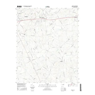
2016 Map of Wingate
USGS Topo · Published 2016About this map
Wingate and the eastern outskirts of Monroe are depicted here along the CSX Transportation rail line during a period of steady suburban and rural development in Union County. The landscape is defined by a dense network of country roads connecting established community centers like Rock Rest and Allens Crossroads. For those tracing local families, the map is remarkably thorough in its documentation of rural religious life, featuring numerous church-affiliated cemeteries such as Meadowbranch-Wingate Baptist Church Cem, Nicey Grove Church Cem, and Smyrna Church Cem. The terrain is characterized by a series of branching waterways including Rays Fork, Beaverdam Cr, and Lanes Cr, which divide the agricultural tracts and timberlands of the Piedmont. These water bodies, paired with family-named landmarks like Bennett-Bivens Cem, provide a detailed view of the area's social and physical geography before further modernization.
Find a feature on this map
163 named features on this map. Tap any name to fly to it.
Don’t see what you’re looking for? This feature index may not catch every label — zoom into the map to look around manually.
Map Details
Editions of this 2016 Wingate Map
This is the sole edition of this map. No revisions or reprints were ever made.
Other maps of this area

1941 · Charlotte
USGS Topo · 1:125,000

1941 · Spartanburg
USGS Topo · 1:250,000

1942 · Charlotte
USGS Topo · 1:125,000

1953 · Spartanburg
USGS Topo · 1:250,000

1953 · Charlotte
USGS Topo · 1:250,000

1954 · Charlotte
USGS Topo · 1:250,000

1960 · Charlotte
USGS Topo · 1:250,000

1960 · Spartanburg
USGS Topo · 1:250,000

1962 · Charlotte
USGS Topo · 1:250,000

1963 · Spartanburg
USGS Topo · 1:250,000