2022 Map of Winslow
USGS Topo · Published 2022About this map
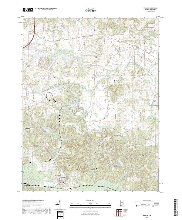
Winslow anchors the southern portion of this Pike County landscape, situated along the banks of the Patoka River. The topography is defined by a dense network of watercourses, including Mud Cr, Pond Cr, and Flat Cr, which drain the varied terrain surrounding small agricultural and residential nodes. The area is marked by numerous historic burial grounds such as Oak Hill Cem, Sunset Cem, and McClure Cem, providing significant points of interest for genealogical research in these rural Indiana townships.
Find a feature on this map
42 named features on this map. Tap any name to fly to it.
Don’t see what you’re looking for? This feature index may not catch every label — zoom into the map to look around manually.
Map Details
Editions of this 2022 Winslow Map
This is the sole edition of this map. No revisions or reprints were ever made.