2022 Map of Winter
USGS Topo · Published 2022About this map
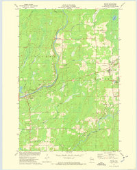
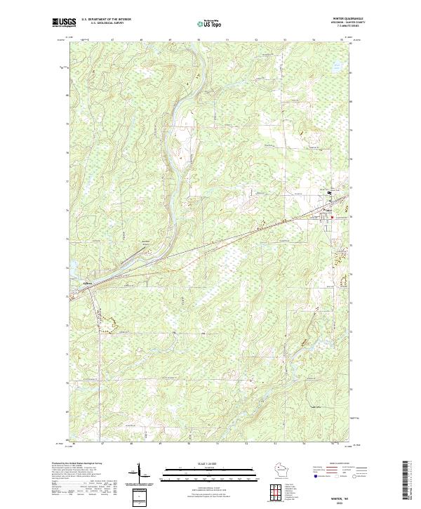
Winter and Ojibwa serve as the primary nodes of human activity in this Sawyer County landscape, situated along the diagonal path of the Tuscobia State Trl. The terrain is defined by a dense network of hydrologic features, most notably the winding Chippewa River and the Brunet River, which are fed by numerous small tributaries like Knapp Stout Cr and Crazy Horse Creek. This 2022 survey illustrates a region where local transit relies on a mix of county highways and named rural routes such as Polish Rd and Aboine Rd. Genealogy and local history researchers will find the locations of Winter Cem and Saint Peter's Cem northeast of the main settlement. The presence of Rainbow Airport near the intersection of Tuscobia State Trl and Co Hwy G highlights the modern logistical infrastructure integrated into this wooded, water-rich environment.
Find a feature on this map
58 named features on this map. Tap any name to fly to it.
Don’t see what you’re looking for? This feature index may not catch every label — zoom into the map to look around manually.
Map Details
Editions of this 2022 Winter Map
This is the sole edition of this map. No revisions or reprints were ever made.