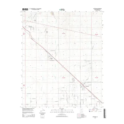
2014 Map of Wittmann
USGS Topo · Published 2014About this map
Wittmann and Circle City stand as the primary hubs in this arid landscape northwest of Surprise, where the desert floor is defined by a series of significant drainage systems. The alluvial character of the terrain is evident in the paths of Little San Domingo Wash, Iona Wash, and Trilby Wash, which traverse the region toward the southeast. Settlement patterns are closely tied to the diagonal corridor of NW Grand Ave and Us-60, which link the various desert communities. In addition to the primary townships, the map reveals a notable concentration of private aviation infrastructure, including Castle Well Airport, Roesner Ranch Airport, and the Thunder Ridge Airpark. These features, alongside a grid of residential streets such as W Dove Valley Rd and W Myers St, document the expansion of residential and recreational developments into the open desert plains during the early 21st century.
Find a feature on this map
67 named features on this map. Tap any name to fly to it.
Don’t see what you’re looking for? This feature index may not catch every label — zoom into the map to look around manually.
Map Details
Editions of this 2014 Wittmann Map
This is the sole edition of this map. No revisions or reprints were ever made.
Other maps of this area

1954 · Phoenix
USGS Topo · 1:250,000

1957 · Phoenix
USGS Topo · 1:250,000

1957 · White Tank Mts. NE
USGS Topo · 1:24,000

1957 · McMicken Dam
USGS Topo · 1:24,000

1957 · White Tank Mts.
USGS Topo · 1:62,500

1958 · Phoenix
USGS Topo · 1:250,000

1960 · Phoenix
USGS Topo · 1:250,000
1964 · Garfias Mountain
USGS Topo · 1:24,000
1964 · Wickenburg
USGS Topo · 1:24,000
1964 · Red Picacho
USGS Topo · 1:24,000