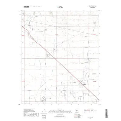
2018 Map of Wittmann
USGS Topo · Published 2018About this map
The desert landscape of the Northwest Valley in the late 2010s reveals a transition from rural outposts to expanding suburban development. Wittmann and Circle City serve as primary hubs along the diagonal transit corridor, while the encroaching footprint of Surprise appears at the southeastern edge. This era is characterized by a high density of specialized aviation and industrial facilities, including the Chrysler Corp Proving grounds and several private landing strips like Castle Well Airport, Roesner Ranch Airport, and Thunder Ridge Airpark. The natural topography is defined by significant drainage systems such as Trilby Wash, Iona Wash, and Little San Domingo Wash, which intersect the grid of county roads. Smaller residential streets like W Little Ponderosa Way and W White Brush Ct show the gradual infilling of the desert between the established ranching and industrial zones.
Find a feature on this map
71 named features on this map. Tap any name to fly to it.
Don’t see what you’re looking for? This feature index may not catch every label — zoom into the map to look around manually.
Map Details
Editions of this 2018 Wittmann Map
This is the sole edition of this map. No revisions or reprints were ever made.
Other maps of this area

1954 · Phoenix
USGS Topo · 1:250,000

1957 · Phoenix
USGS Topo · 1:250,000

1957 · White Tank Mts. NE
USGS Topo · 1:24,000

1957 · McMicken Dam
USGS Topo · 1:24,000

1957 · White Tank Mts.
USGS Topo · 1:62,500

1958 · Phoenix
USGS Topo · 1:250,000

1960 · Phoenix
USGS Topo · 1:250,000
1964 · Garfias Mountain
USGS Topo · 1:24,000
1964 · Wickenburg
USGS Topo · 1:24,000
1964 · Red Picacho
USGS Topo · 1:24,000