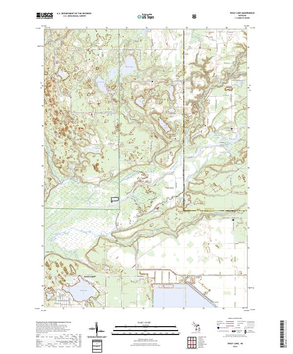
2023 Map of Wolf Lake
USGS Topo · Published 2023About this map
Wolf Lake and its surrounding residential streets anchor the southwestern corner of this survey, where local life follows the water’s edge near Indian Point. To the north and east, the landscape transitions into the wooded expanse of the Manistee National Forest, a territory marked by numerous glacial lakes and the meandering courses of the Muskegon River and Maple River. This area serves as a significant historical crossroads, evidenced by the scattered small burial grounds that dot the countryside, including Indian Cem, Saint Anthonys Cem, and Johnson Cem. The complex hydrography of the region is further defined by Maple Island and Troque Island, which sit at the confluence of several waterways. These features, along with names like Chidester Cem, provide a detailed record of local genealogy and land use across the Muskegon and Newaygo county line.
Find a feature on this map
66 named features on this map. Tap any name to fly to it.
Don’t see what you’re looking for? This feature index may not catch every label — zoom into the map to look around manually.
Map Details
Editions of this 2023 Wolf Lake Map
This is the sole edition of this map. No revisions or reprints were ever made.
Other maps of this area

1930 · Muskegon
USGS Topo · 1:62,500

1936 · Muskegon
USGS Topo · 1:62,500

1945 · Ravenna
USGS Topo · 1:62,500

1954 · Milwaukee
USGS Topo · 1:250,000

1954 · Midland
USGS Topo · 1:250,000

1958 · Midland
USGS Topo · 1:250,000

1958 · Milwaukee
USGS Topo · 1:250,000

1958 · Twin Lake
USGS Topo · 1:62,500

1958 · Fremont
USGS Topo · 1:62,500

1959 · Midland
USGS Topo · 1:250,000
Featured Places
- Wolf Lake, MI
- Moorland Township, MI
- Egelston Township, MI
- Cedar Creek Township, MI
- Bridgeton Township, MI