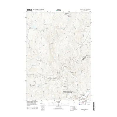
2015 Map of Woodstock North
USGS Topo · Published 2015About this map
Marsh-Billings-Rockefeller National Historical Park anchors the southern portion of this region, preserving a landscape tied to the birth of the conservation movement in Vermont. The terrain is defined by a dense network of high points including Mt Tom, Hurricane Hill, and Teago Hill, which overlook the village of Woodstock and the winding Ottauquechee River. To the north, the historic village of Barnard sits near the shores of Silver Lake, with the surrounding hillsides marked by numerous family and community burial grounds such as Old Cem and the Village Cem. The Appalachian National Scenic Trail traverses the center of the quadrangle, cutting through the high country of Dana Hill and Totman Hill. Notable engineering landmarks like the Middle Covered Bridge and the Elm Street Bridge span the local waterways, reflecting the region's enduring small-town character and architectural heritage.
Find a feature on this map
104 named features on this map. Tap any name to fly to it.
Don’t see what you’re looking for? This feature index may not catch every label — zoom into the map to look around manually.
Map Details
Editions of this 2015 Woodstock North Map
This is the sole edition of this map. No revisions or reprints were ever made.
Other maps of this area

1896 · Strafford
USGS Topo · 1:62,500

1906 · Hanover
USGS Topo · 1:62,500

1908 · Hanover
USGS Topo · 1:62,500

1911 · Woodstock
USGS Topo · 1:62,500

1913 · Woodstock
USGS Topo · 1:62,500

1919 · Royalton
USGS Topo · 1:62,500

1924 · Randolph
USGS Topo · 1:48,000

1926 · Randolph
USGS Topo · 1:62,500

1943 · Woodstock
USGS Topo · 1:62,500

1944 · Strafford
USGS Topo · 1:62,500