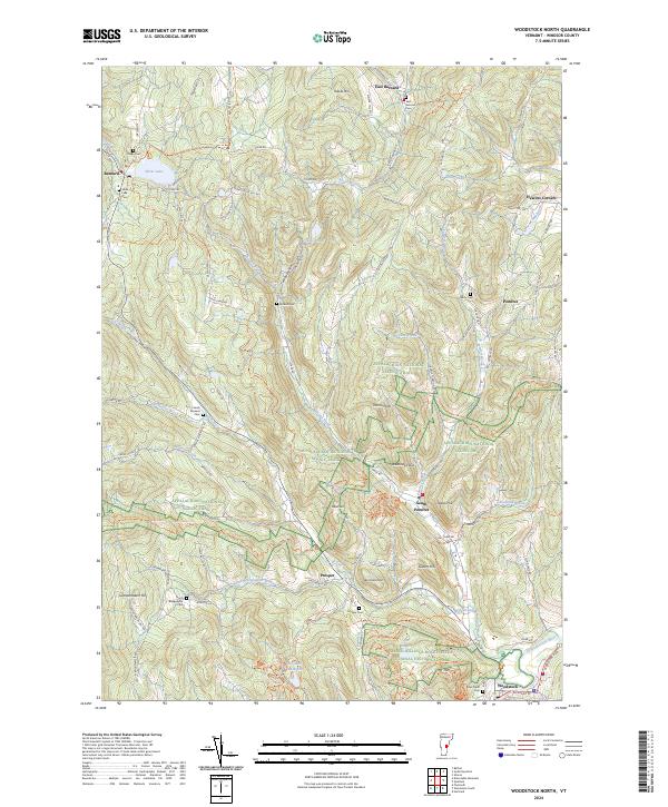
2024 Map of Woodstock North
USGS Topo · Published 2024About this map
Marsh-Billings-Rockefeller National Historical Park dominates the southeastern quadrant of this Vermont landscape, where the historic hills meet the village of Woodstock. The terrain is defined by a dense network of high ridges and deep valleys, anchored by summits like Mt Tom and Hawks Hill. Settlement patterns follow the winding waterways of the Ottauquechee River and Gulf Stream, connecting small hamlets such as East Barnard, Pomfret, and Prosper.
Find a feature on this map
95 named features on this map. Tap any name to fly to it.
Don’t see what you’re looking for? This feature index may not catch every label — zoom into the map to look around manually.
Map Details
Editions of this 2024 Woodstock North Map
This is the sole edition of this map. No revisions or reprints were ever made.
Other maps of this area

1896 · Strafford
USGS Topo · 1:62,500

1906 · Hanover
USGS Topo · 1:62,500

1908 · Hanover
USGS Topo · 1:62,500

1911 · Woodstock
USGS Topo · 1:62,500

1913 · Woodstock
USGS Topo · 1:62,500

1919 · Royalton
USGS Topo · 1:62,500

1924 · Randolph
USGS Topo · 1:48,000

1926 · Randolph
USGS Topo · 1:62,500

1943 · Woodstock
USGS Topo · 1:62,500

1944 · Strafford
USGS Topo · 1:62,500