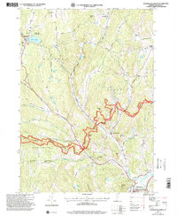
1997 Map of Woodstock North
USGS Topo · Published 2000About this map
Silver Lake State Park and the village of Barnard anchor the northwestern corner of this Windsor County landscape, where the terrain transitions into the protected highlands of the Green Mountain National Forest. This late 20th-century survey documents a network of rural settlements including East Barnard, Pomfret, South Pomfret, and Woodstock, all connected by historic thoroughfares like the Royalton Turnpike and Woodstock Stage Road. The map reveals a high concentration of genealogical data, with numerous burial sites such as Prosper Cem and Burns Cem scattered across the hillsides.
Find a feature on this map
61 named features on this map. Tap any name to fly to it.
Don’t see what you’re looking for? This feature index may not catch every label — zoom into the map to look around manually.
Map Details
Editions of this 1997 Woodstock North Map
This is the sole edition of this map. No revisions or reprints were ever made.
Other maps of this area

1896 · Strafford
USGS Topo · 1:62,500

1906 · Hanover
USGS Topo · 1:62,500

1908 · Hanover
USGS Topo · 1:62,500

1911 · Woodstock
USGS Topo · 1:62,500

1913 · Woodstock
USGS Topo · 1:62,500

1919 · Royalton
USGS Topo · 1:62,500

1924 · Randolph
USGS Topo · 1:48,000

1926 · Randolph
USGS Topo · 1:62,500

1943 · Woodstock
USGS Topo · 1:62,500

1944 · Strafford
USGS Topo · 1:62,500