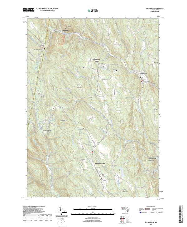
2024 Map of Worthington
USGS Topo · Published 2024About this map
The Middle Branch Westfield River and its numerous tributaries, such as Bronson Brook and Childs Brook, carve through the upland landscape of the Berkshire foothills. This modern survey illustrates a network of small villages and crossroads, including Worthington Center and Cummington, which remain connected by the historic Berkshire Trl. The map provides significant detail for local historians, documenting numerous burial grounds like Village Cem and North Cem that anchor these long-established communities.
Find a feature on this map
61 named features on this map. Tap any name to fly to it.
Don’t see what you’re looking for? This feature index may not catch every label — zoom into the map to look around manually.
Map Details
Editions of this 2024 Worthington Map
This is the sole edition of this map. No revisions or reprints were ever made.
Other maps of this area

1886 · Greylock
USGS Topo · 1:62,500

1886 · Hawley
USGS Topo · 1:62,500

1886 · Chesterfield
USGS Topo · 1:62,500

1886 · Becket
USGS Topo · 1:62,500

1888 · Becket
USGS Topo · 1:62,500

1888 · Chesterfield
USGS Topo · 1:62,500

1890 · Hawley
USGS Topo · 1:62,500

1891 · Greylock
USGS Topo · 1:62,500

1893 · Chesterfield
USGS Topo · 1:62,500

1893 · Becket
USGS Topo · 1:62,500