2022 Map of Wyocena
USGS Topo · Published 2022About this map
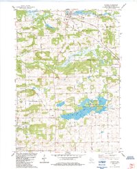
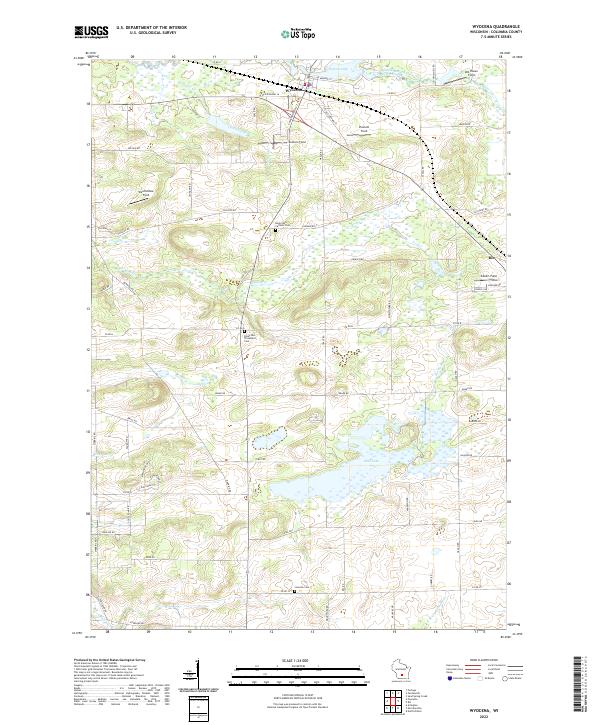
Wyocena sits at the junction of Curtis Cr and the Middle Branch Duck Creek, characterized by a landscape of glacial lakes and small stream networks. The topography is defined by significant water bodies such as Wyona Lake and the expansive Mud Lake to the south. Local history is anchored by several denominational burial grounds, specifically the Rocky Run Catholic Cem and Rocky Run Protestant Cem located central to the quadrangle, along with the Lowville Cem further south. The region's agricultural character is evident through several named family fields, including Knutson Field, Weatherbee Field, and Gilbert Field, which suggest established generational landholdings. To the southeast, the headwaters of the N Br Crawfish River begin to take shape, marking a drainage divide in this part of Columbia County.
Find a feature on this map
70 named features on this map. Tap any name to fly to it.
Don’t see what you’re looking for? This feature index may not catch every label — zoom into the map to look around manually.
Map Details
Editions of this 2022 Wyocena Map
This is the sole edition of this map. No revisions or reprints were ever made.