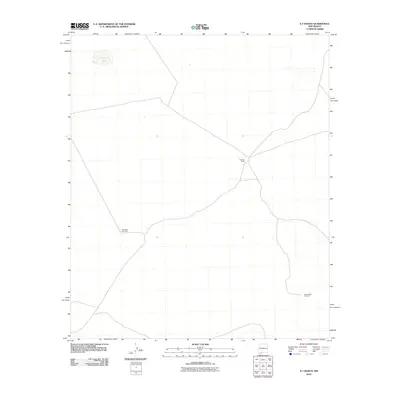
2010 Map of X-7 Ranch
USGS Topo · Published 2010About this map
X-Seven Ranch serves as a central point in this arid New Mexico landscape, where water management is the primary driver of human infrastructure. The presence of the San Pedro Windmill and Sweetwater Windmill indicates the critical reliance on groundwater to support ranching operations across the sparse Chihuahuan Desert terrain. In the northwestern corner, San Luis Lake provides a rare surface water feature in an otherwise dry expanse defined by a network of unimproved roads and cattle trails. This 2010 survey by the U.S. Geological Survey captures the functional layout of large-scale ranching before modern development, preserving the locations of the named water sources and livestock stations that have sustained this region of Doña Ana County for generations.
Find a feature on this map
4 named features on this map. Tap any name to fly to it.
Don’t see what you’re looking for? This feature index may not catch every label — zoom into the map to look around manually.
Map Details
Editions of this 2010 X-7 Ranch Map
This is the sole edition of this map. No revisions or reprints were ever made.
Other maps of this area

1917 · Camel Mountain
USGS Topo · 1:62,500

1917 · Mt. Riley
USGS Topo · 1:62,500

1918 · Mt. Riley
USGS Topo · 1:62,500

1929 · Mt. Riley
USGS Topo · 1:62,500

1941 · Aden
USGS Topo · 1:62,500

1943 · Aden
USGS Topo · 1:62,500

1951 · Mt. Riley
USGS Topo · 1:62,500

1953 · El Paso
USGS Topo · 1:250,000

1955 · Las Cruces
USGS Topo · 1:250,000

1958 · Las Cruces
USGS Topo · 1:250,000