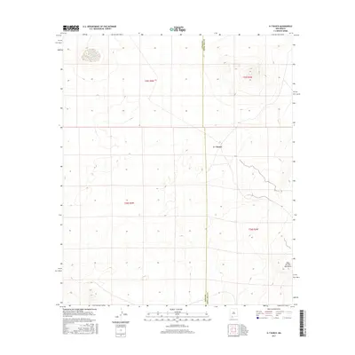
2017 Map of X-7 Ranch
USGS Topo · Published 2017About this map
X-7 Ranch sits at the heart of this high-desert landscape in Doña Ana County, marking a site of human habitation in a region primarily defined by its topographic extremes. The eastern edge of the quadrangle is dominated by the West Potrillo Mountains, a volcanic field featuring distinct cinder cones and depressions that define the local relief. The map illustrates a significant administrative boundary where Luna Co meets Dona Ana Co, a line that cuts through the arid basins and volcanic rises. This 2017 survey reflects the enduring cattle ranching tradition of the southern New Mexico borderlands, where vast stretches of range land are managed across township lines like t25s r5w and t26s r4w. The landscape is a study in isolation, showing the sparse infrastructure required to support the remote ranching operations of the desert southwest.
Find a feature on this map
7 named features on this map. Tap any name to fly to it.
Don’t see what you’re looking for? This feature index may not catch every label — zoom into the map to look around manually.
Map Details
Editions of this 2017 X-7 Ranch Map
This is the sole edition of this map. No revisions or reprints were ever made.
Other maps of this area

1917 · Camel Mountain
USGS Topo · 1:62,500

1917 · Mt. Riley
USGS Topo · 1:62,500

1918 · Mt. Riley
USGS Topo · 1:62,500

1929 · Mt. Riley
USGS Topo · 1:62,500

1941 · Aden
USGS Topo · 1:62,500

1943 · Aden
USGS Topo · 1:62,500

1951 · Mt. Riley
USGS Topo · 1:62,500

1953 · El Paso
USGS Topo · 1:250,000

1955 · Las Cruces
USGS Topo · 1:250,000

1958 · Las Cruces
USGS Topo · 1:250,000