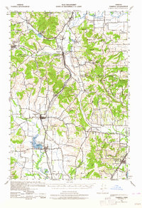
1941 Map of Yamhill
USGS Topo · Published 1964About this map
The Stimson Lumber Company Railroad winds through the northern hills of this 1941 survey, serving the Stimson Lumber Camp and a large Sawmill in a landscape dominated by timber and agriculture. Central to the region, the town of Gaston sits near the headwaters of the Tualatin River, while the southern corridor follows the Southern Pacific line through the farming communities of Yamhill, Carlton, and Dundee. This era reveals a dense network of local education, including the Laurelwood Academy and over twenty rural schoolhouses such as Pioneer Sch and White Cloud Sch. The topography transitions from the alluvial plains of Wapato Creek to the prominent Chehalem Mountains, where Bald Peak and Ribbon Ridge overlook the renowned Red Hills of Dundee.
Find a feature on this map
63 named features on this map. Tap any name to fly to it.
Don’t see what you’re looking for? This feature index may not catch every label — zoom into the map to look around manually.
Map Details
Editions of this 1941 Yamhill Map
2 editions found

Other maps of this area

1915 · Hillsboro
USGS Topo · 1:62,500

1916 · Tualatin
USGS Topo · 1:62,500

1918 · Hillsboro
USGS Topo · 1:62,500

1923 · Mount Angel
USGS Topo · 1:62,500

1924 · Mc Minnville
USGS Topo · 1:48,000

1926 · Mc Minnville
USGS Topo · 1:62,500

1939 · Tualatin
USGS Topo · 1:62,500

1940 · McMinnville
USGS Topo · 1:62,500

1940 · Tualatin
USGS Topo · 1:62,500

1940 · Hillsboro
USGS Topo · 1:62,500