2022 Map of Yates Center
USGS Topo · Published 2022About this map
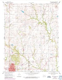
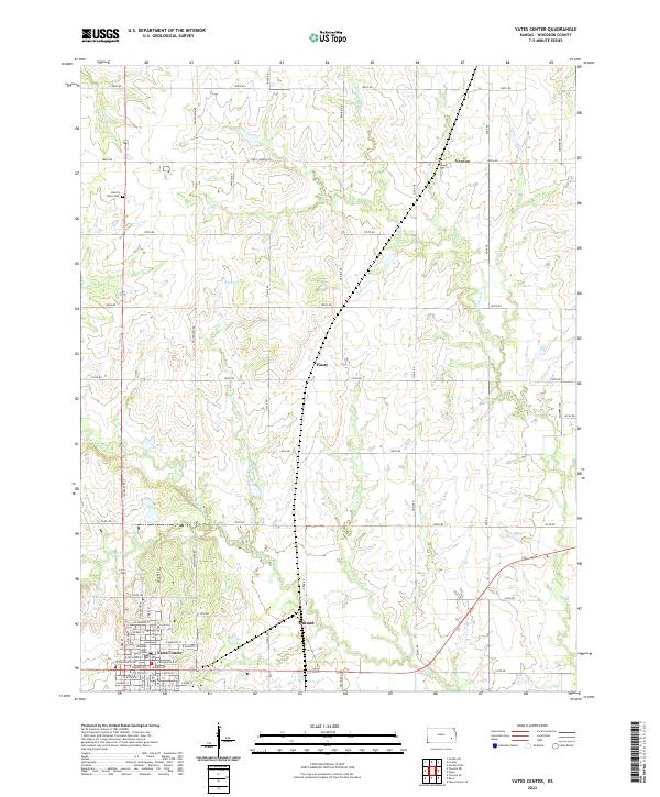
The Woodson County Courthouse stands as the central landmark in Yates Center, where a dense grid of residential streets including W Bell St and N Green St marks the county seat's layout. The surrounding landscape is defined by the headwaters of Owl Cr and School Creek, which carve gentle drainage patterns through the agricultural terrain. To the north and east, small rural clusters like Vernon, Hasty, and Durand illustrate the historically dispersed settlement patterns of Woodson County.
Find a feature on this map
65 named features on this map. Tap any name to fly to it.
Don’t see what you’re looking for? This feature index may not catch every label — zoom into the map to look around manually.
Map Details
Editions of this 2022 Yates Center Map
This is the sole edition of this map. No revisions or reprints were ever made.