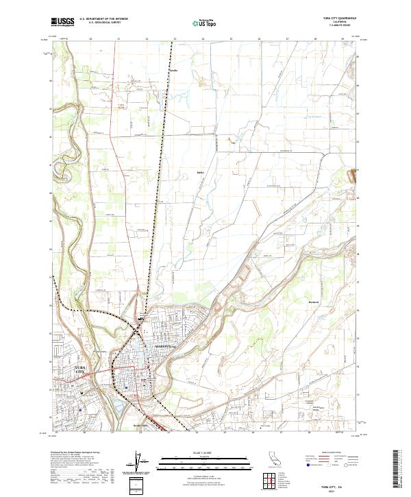
2021 Map of Yuba City
USGS Topo · Published 2021About this map
The confluence of the Feather River and the Yuba River defines this landscape of levee-protected cities and rich alluvial plains. In the heart of Marysville, historic civic landmarks like the Yuba County Courthouse stand near the waters of Ellis Lake, while the neighboring Yuba City extends westward from the riverbanks. The survey provides significant detail for genealogists, documenting the Marysville Cem, Yuba City Cem, and the specialized Marysville Jewish Cem. Outside the primary urban centers, smaller settlements such as Tambo, Mello, and Dantoni reflect the agricultural and industrial footprint of the valley. Complex water management is evident through features like the Cordua Canal, Stahl Ditch, and Jack Slough, which navigate the terrain alongside the Old River Channel. Higher education and modern infrastructure are represented by the presence of Yuba College and the developed corridors of Hammonton Smartville Rd and Browns Valley Rd.
Find a feature on this map
141 named features on this map. Tap any name to fly to it.
Don’t see what you’re looking for? This feature index may not catch every label — zoom into the map to look around manually.
Map Details
Editions of this 2021 Yuba City Map
This is the sole edition of this map. No revisions or reprints were ever made.
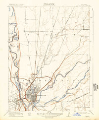
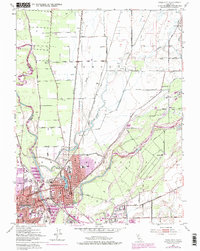
Historical Maps of Yuba City Through Time
4 maps found