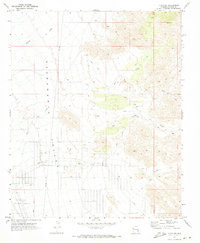
1970 Map of Yucca NE
USGS Topo · Published 1973About this map
The Automotive Proving Ground occupies the southwestern portion of this desert landscape, indicating the mid-century industrial utility of the Arizona backcountry. Broad alluvial washes dominate the Sacramento Valley, where seasonal drainage systems like Walnut Creek, Rock Creek, and Willow Creek carve through the arid terrain. Human activity is marked by a network of Jeep Trails and a prominent north-south Pipeline that bisects the valley floor. The placement of several Water Tanks suggests the critical importance of managed water resources for both the testing facility and local infrastructure during the early 1970s. This survey, grounded in 1969 aerial photography, documents a period when the valley served as a specialized zone for vehicular endurance and utility development.
Find a feature on this map
9 named features on this map. Tap any name to fly to it.
Don’t see what you’re looking for? This feature index may not catch every label — zoom into the map to look around manually.
Map Details
Editions of this 1970 Yucca NE Map
This is the sole edition of this map. No revisions or reprints were ever made.
Other maps of this area

1886 · Diamond Creek
USGS Topo · 1:250,000

1886 · Camp Mohave
USGS Topo · 1:250,000

1892 · Diamond Creek
USGS Topo · 1:250,000

1892 · Camp Mohave
USGS Topo · 1:250,000

1923 · Signal
USGS Topo · 1:250,000

1927 · Yucca
USGS Topo · 1:62,500

1929 · Yucca
USGS Topo · 1:62,500

1942 · Camp Mohave
USGS Topo · 1:250,000

1942 · Signal
USGS Topo · 1:250,000

1947 · Kingman
USGS Topo · 1:250,000