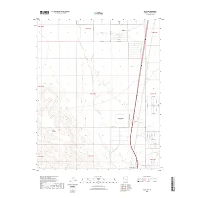
2018 Map of Yucca NW
USGS Topo · Published 2018About this map
Black Mesa and the western slopes of the Black Mountains dominate this high-desert landscape in Mohave County. The terrain is defined by a network of drainage systems including the Sacramento Wash, Black Rock Wash, and Walnut Creek, which flow toward the lower elevations of the Mojave Desert. This arid environment is punctuated by vital water sources such as Caliche Spring, essential for the survival of early settlements in the region. Near the eastern edge of the map, the site of Athos sits along the transportation corridor that parallels the mountain range. To the south, the Yucca Cem provides a genealogical connection to the families who established themselves in this demanding environment, while the proximity of Rock Creek and Willow Creek further illustrates the hydrological patterns that dictated land use in the area.
Find a feature on this map
38 named features on this map. Tap any name to fly to it.
Don’t see what you’re looking for? This feature index may not catch every label — zoom into the map to look around manually.
Map Details
Editions of this 2018 Yucca NW Map
This is the sole edition of this map. No revisions or reprints were ever made.
Other maps of this area

1886 · Camp Mohave
USGS Topo · 1:250,000

1892 · Camp Mohave
USGS Topo · 1:250,000

1903 · Needles
USGS Topo · 1:125,000

1904 · Needles Special
USGS Topo · 1:125,000

1927 · Yucca
USGS Topo · 1:62,500

1929 · Yucca
USGS Topo · 1:62,500

1942 · Camp Mohave
USGS Topo · 1:250,000

1947 · Kingman
USGS Topo · 1:250,000

1948 · Kingman
USGS Topo · 1:250,000

1954 · Needles
USGS Topo · 1:250,000