Old Maps of Kayangel for Hiking & Exploration
Hike through history with 2 historic maps of Kayangel. Explore old trails, ghost towns, and forgotten backroads — perfect for outdoor adventurers and local explorers.
- Rediscover forgotten places: Map out old mining camps, roads, and footpaths that no longer exist on modern maps.
- Layer with modern tools: Combine with LiDAR or satellite views to plan hikes through historical terrain.
- Made for exploration: Popular among hikers, overlanders, and local history lovers.
Use these maps to find adventure and explore the hidden past of Kayangel.
Kayangel maps
(2)- 1984 Map of Ngcheangel
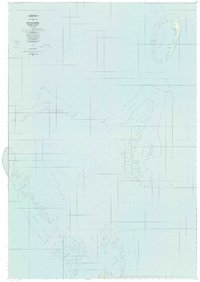 1984 Ngcheangel1984 Print · USGSNgcheangel atoll in the mid-1980s reveals a traditional Pacific settlement pattern structured around its reefs and lagoons. Researchers can locate coastal villages such as Dilong and Ngerlunga or trace the navigational channels of Toachel Ngerchelong.
 - 2001 Map of Kayangel South, 2004 Print
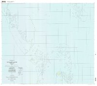 2001 Kayangel South2004 Print · USGSNorthern Palau waters and reef systems are captured here as they appeared at the turn of the millennium. Nautical researchers and historians can trace the coral reefs of Ngebard and locate island landmarks like Ngerechur and the Ruins at its center.
End of results
Showing maps 1-2 of 2
Frequently asked questions
- What are the different types of historical maps available for Kayangel?
- What is the oldest map of Kayangel?
- Where can I purchase historical maps of Kayangel for my home or office?
- Where can I download high-res historical maps of Kayangel?
- Are there historical topographic maps available for Kayangel?
- Is there historical aerial imagery available for Kayangel?
- Where are historical maps of Kayangel sourced from?