Old Maps of Villas del Río Ingenio, Aguada for Genealogy
Trace your family roots with 9 historic maps of Villas del Río Ingenio. These high-res maps reveal old neighborhoods, homesites, landmarks, and streets — helping you uncover where your ancestors lived and how the area evolved over time.
- Explore historic neighborhoods: Identify where your relatives may have lived in the 1800s or 1900s.
- Compare maps over time: Trace the changes in streets, buildings, and landmarks for multi-generational research.
- Perfect for genealogy & ancestry research: Used by family historians and researchers to map out lineage and migration.
These maps are an incredible resource for exploring your personal connection to Villas del Río Ingenio's past.
Villas del Río Ingenio, Aguada maps
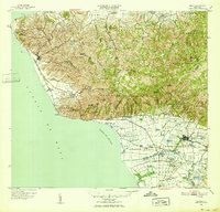
(9)- 1941 Map of Rincon
 1941 Rincon1941 Print · USGSCovers Villas del Río Ingenio, including Añasco, Sector Los Ríos, and other nearby areas
 - 1941 Map of Rincon
 1941 Rincon1941 Print · USGSCovers Villas del Río Ingenio, including Añasco, Rincón, and other nearby areas
 - 1947 Map of Rincon
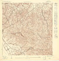
 1947 Rincon1947 Print · USGSCovers Villas del Río Ingenio, including Añasco, Rincón, and other nearby areas2 unique versions available
 - 1947 Map of Rincon
 1947 Rincon1947 Print · USGSCovers Villas del Río Ingenio, including Añasco, Sector Los Ríos, and other nearby areas
 - 1949 Map of Rincon, 1952 Print
 1949 Rincon1952 Print · USGSCovers Villas del Río Ingenio, including Añasco, Rincón, and other nearby areas2 unique versions available
 - 1950 Map of Rincon NO
 1950 Rincon NO1950 Print · USGSCovers Villas del Río Ingenio, including Bajío, Sector Rito Ríos, and other nearby areas
 - 1955 Map of Rincon, 1958 Print
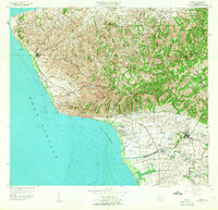 1955 Rincon1958 Print · USGSCovers Villas del Río Ingenio, including Añasco, Rincón, and other nearby areas
 - 1966 Map of Rincon, 1969 Print
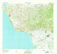 1966 Rincon1969 Print · USGSCovers Villas del Río Ingenio, including Añasco, Rincón, and other nearby areas2 unique versions available
 - 2024 Map of Rincon, 2024 Print
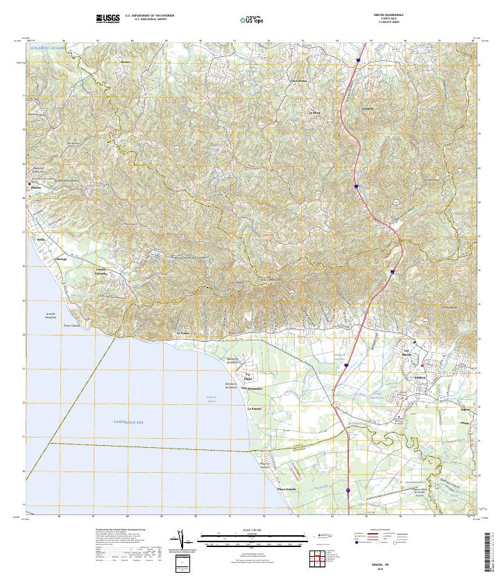 2024 Rincon2024 Print · USGSCovers Villas del Río Ingenio, including Añasco, Sector Los Ríos, and other nearby areas
End of results
Showing maps 1-9 of 9
Top cities near Villas del Río Ingenio
- Mayagüez historical maps
- Hormigueros historical maps
- Aguadilla historical maps
- Isabela historical maps
- San Sebastián historical maps
- Añasco historical maps
See more
Frequently asked questions
- What are the different types of historical maps available for Villas del Río Ingenio?
- What is the oldest map of Villas del Río Ingenio?
- Where can I purchase historical maps of Villas del Río Ingenio for my home or office?
- Where can I download high-res historical maps of Villas del Río Ingenio?
- Are there historical topographic maps available for Villas del Río Ingenio?
- Is there historical aerial imagery available for Villas del Río Ingenio?
- Where are historical maps of Villas del Río Ingenio sourced from?