1970s Maps of Esperanza, Arecibo
Explore 3 historic maps of Esperanza from the 1970s. These maps offer a rare glimpse into what life looked like during the 1970s — showing old roads, neighborhoods, homes, and landmarks that have changed or disappeared over time.
Whether you're researching your family's past, planning a metal detecting trip, or studying how Esperanza's landscape evolved across the 1970s, these high-resolution maps are a powerful tool for exploring the history of this region.
- Focus on a specific era: All maps on this page are from the 1970s, giving you a focused view of this time period.
- See what’s changed: Compare century-old streets, trails, and buildings to today's modern landscape using overlays and satellite layers.
- Research with precision: Use these maps for genealogy, historical research, land use analysis, or educational projects.
- View, download, or print: Maps are fully viewable online in high resolution, and can be downloaded or printed for your own records.
Start exploring Esperanza's history through authentic maps from the 1970s. This is your window into the past.
Esperanza, Arecibo maps
(3)- 1970 Map of Bayaney, 1973 Print
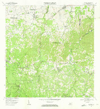 1970 Bayaney1973 Print · USGSThe limestone hills and river valleys south of Hatillo come to life in the early seventies, showing a landscape of coffee-country barrios and mountain schools. Trace ancestral roots through Angeles, Bayaney, and landmarks like the Observatorio de Arecibo.3 unique versions available
 - 1972 Map of Utuado, 1974 Print
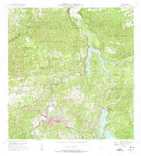 1972 Utuado1974 Print · USGSThe heart of Puerto Rico's central mountains comes into focus during the early seventies as the island’s interior infrastructure matured. Local historians can trace family-named landmarks like Hacienda Carbonell or locate rural parishes such as Iglesia San Pascual and Iglesia Santa Maria del Monte Carmelo.5 unique versions available
 - 1972 Map of Camuy, 1974 Print
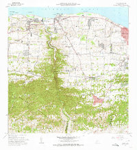 1972 Camuy1974 Print · USGSThe northern coast of Puerto Rico is shown here in the early seventies, spanning from the mouth of the Río Camuy to Radioville. Genealogists can trace family footprints through the Cementerio Municipal and local schools like the Escuela Manuel A Rivera.3 unique versions available
End of results
Showing maps 1-3 of 3
Frequently asked questions
- What are the different types of historical maps available for Esperanza?
- What is the oldest map of Esperanza?
- Where can I purchase historical maps of Esperanza for my home or office?
- Where can I download high-res historical maps of Esperanza?
- Are there historical topographic maps available for Esperanza?
- Is there historical aerial imagery available for Esperanza?
- Where are historical maps of Esperanza sourced from?