Old Maps of Hato Arriba, Arecibo for Genealogy
Trace your family roots with 13 historic maps of Hato Arriba. These high-res maps reveal old neighborhoods, homesites, landmarks, and streets — helping you uncover where your ancestors lived and how the area evolved over time.
- Explore historic neighborhoods: Identify where your relatives may have lived in the 1800s or 1900s.
- Compare maps over time: Trace the changes in streets, buildings, and landmarks for multi-generational research.
- Perfect for genealogy & ancestry research: Used by family historians and researchers to map out lineage and migration.
These maps are an incredible resource for exploring your personal connection to Hato Arriba's past.
Hato Arriba, Arecibo maps
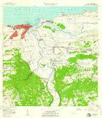
(13)- 1938 Map of Camuy
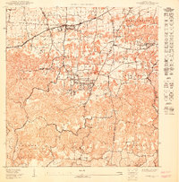
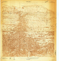 1938 Camuy1938 Print · USGSCovers Hato Arriba, including Hatillo, Camuy, and other nearby areas
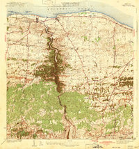
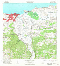
 - 1942 Map of Arecibo
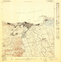
 1942 Arecibo1942 Print · USGSCovers Hato Arriba, including Arecibo, Reparto Capitolio, and other nearby areas
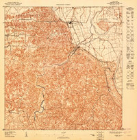
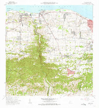
 - 1942 Map of Camuy
 1942 Camuy1942 Print · USGSCovers Hato Arriba, including Hatillo, Camuy, and other nearby areas5 unique versions available
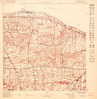
 - 1946 Map of Arecibo
 1946 Arecibo1946 Print · USGSCovers Hato Arriba, including Arecibo, Reparto Capitolio, and other nearby areas3 unique versions available
 - 1947 Map of Arecibo SO
 1947 Arecibo SO1947 Print · USGSCovers Hato Arriba, including Villa Vélez, Sector Pueblo de Paja, and other nearby areas
 - 1950 Map of Camuy NE
 1950 Camuy NE1950 Print · USGSCovers Hato Arriba, including Estancias de Vista Verde, Las Cunetas, and other nearby areas
 - 1950 Map of Arecibo NO
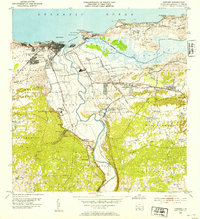
 1950 Arecibo NO1950 Print · USGSCovers Hato Arriba, including Arecibo, Reparto Diocesano, and other nearby areas
 - 1950 Map of Camuy SE
 1950 Camuy SE1950 Print · USGSCovers Hato Arriba, including Cuchí 1, Cuchí 2, and other nearby areas
 - 1953 Map of Arecibo, 1954 Print
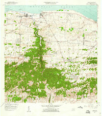
 1953 Arecibo1954 Print · USGSCovers Hato Arriba, including Arecibo, Reparto Capitolio, and other nearby areas
 - 1957 Map of Camuy, 1960 Print
 1957 Camuy1960 Print · USGSCovers Hato Arriba, including Hatillo, Camuy, and other nearby areas2 unique versions available
 - 1957 Map of Arecibo, 1961 Print
 1957 Arecibo1961 Print · USGSCovers Hato Arriba, including Arecibo, Reparto Capitolio, and other nearby areas
 - 1964 Map of Arecibo, 1968 Print
 1964 Arecibo1968 Print · USGSCovers Hato Arriba, including Arecibo, Reparto Capitolio, and other nearby areas4 unique versions available
 - 1972 Map of Camuy, 1974 Print
 1972 Camuy1974 Print · USGSCovers Hato Arriba, including Hatillo, Camuy, and other nearby areas3 unique versions available
End of results
Showing maps 1-13 of 13
Frequently asked questions
- What are the different types of historical maps available for Hato Arriba?
- What is the oldest map of Hato Arriba?
- Where can I purchase historical maps of Hato Arriba for my home or office?
- Where can I download high-res historical maps of Hato Arriba?
- Are there historical topographic maps available for Hato Arriba?
- Is there historical aerial imagery available for Hato Arriba?
- Where are historical maps of Hato Arriba sourced from?