Old Maps of Doña Elena, Comerío for Genealogy
Trace your family roots with 31 historic maps of Doña Elena. These high-res maps reveal old neighborhoods, homesites, landmarks, and streets — helping you uncover where your ancestors lived and how the area evolved over time.
- Explore historic neighborhoods: Identify where your relatives may have lived in the 1800s or 1900s.
- Compare maps over time: Trace the changes in streets, buildings, and landmarks for multi-generational research.
- Perfect for genealogy & ancestry research: Used by family historians and researchers to map out lineage and migration.
These maps are an incredible resource for exploring your personal connection to Doña Elena's past.
Doña Elena, Comerío maps
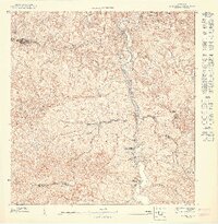
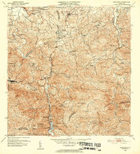
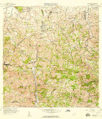
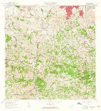
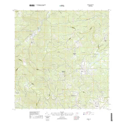
(31)- 1946 Map of Corozal
 1946 Corozal1946 Print · USGSCorozal and the central highlands of Puerto Rico are captured here in the mid-forties, showing a landscape of steep ridges and deep river valleys. Genealogists and local historians can trace the foundations of local education and faith at sites like Escuela Segunda Unidad de Palmarejo and Iglesia La Milagrosa.3 unique versions available
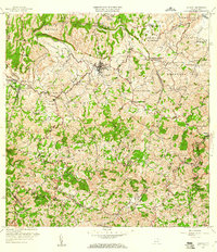
 - 1946 Map of Barranquitas
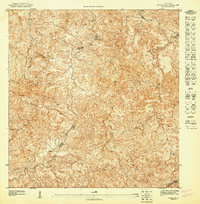
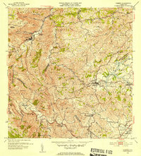
 1946 Barranquitas1946 Print · USGSCentral Puerto Rico during the mid-1940s reveals a landscape of high-elevation settlements and mountain agriculture. Trace rural family roots at Hacienda Córcega or through numerous local schools like Escuela Segunda Unidad de Botijas No 2.3 unique versions available
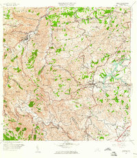
 - 1946 Map of Comerio
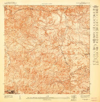
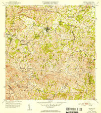
 1946 Comerio1946 Print · USGSThe Puerto Rican interior in the mid-forties shows a landscape of steep coffee-country peaks and river-valley towns. Genealogists can trace family footprints at Cidra, Centro Comunal Nogueras, and the Escuela Segunda Unidad de Toita.3 unique versions available
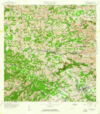
 - 1946 Map of Naranjito
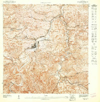
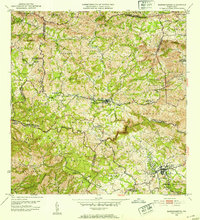
 1946 Naranjito1946 Print · USGSNaranjito and the surrounding mountains of central Puerto Rico appear in the mid-1940s as a landscape of agricultural colonias and emerging utilities. Researchers can locate numerous rural chapels like the Iglesia Guadiana and trace the path of the Acueducto de San Juan through the hills.3 unique versions available
 - 1947 Map of Naranjito SO
 1947 Naranjito SO1947 Print · USGSNaranjito and the central highlands of Puerto Rico appear here in the 1940s, revealing a landscape shaped by the Rio de la Plata. Genealogists and local historians can trace parish sites like Iglesia Parroquial Corazon de Jesus and industrial sites like the Represa de Comerio.
 - 1947 Map of Corozal SE
 1947 Corozal SE1947 Print · USGSThe interior highlands of Puerto Rico are rendered in exceptional detail in this mid-century preliminary survey. Researchers can trace municipal boundaries through the Montañas de Corozal and follow the headwaters of the Río Grande de Manatí and Rio de los Negros.
 - 1947 Map of Barranquitas NE
 1947 Barranquitas NE1947 Print · USGSThe mountain interior of Puerto Rico in the late 1940s reveals a landscape of steep ridges and municipal crossroads. You can trace the rural school system at Escuela Segunda Unidad de Río Hondo and follow the headwaters of the Río Grande de Manatí.
 - 1947 Map of Comerio NO, 1948 Print
 1947 Comerio NO1948 Print · USGSThe mountain interior of Puerto Rico in the late forties reveals a community built along the sharp bends of the Rio de la Plata. Genealogists and historians can trace local homesteads and schools like the Escuela Superior de Comerio and Escuela Segunda Unidad de Palomas.
 - 1952 Map of Naranjito, 1953 Print
 1952 Naranjito1953 Print · USGSNaranjito and the central highlands are captured here in the early fifties, showing a landscape of traditional agricultural colonias and developing barrios. Genealogists can locate specific family landmarks and local institutions like Iglesia de Minillas, Escuela Don Manolo, and the Represa de Comerio.2 unique versions available
 - 1953 Map of Comerio
 1953 Comerio1953 Print · USGSThe central mountains of Puerto Rico are mapped in the early fifties, showcasing the intricate river valleys and developing rural communities. Genealogists and local historians can trace the foundations of the regional school system and community centers like the Centro Comunal Nogueras, Escuela Superior de Comerio, and Cidra.2 unique versions available
 - 1953 Map of Corozal
 1953 Corozal1953 Print · USGSCentral Puerto Rico's interior is captured here in the early fifties as the town of Corozal expanded its infrastructure. Genealogists and historians can locate specific landmarks like the Acueducto de Corozal, Iglesia La Milagrosa, and numerous localized school units.2 unique versions available
 - 1953 Map of Barranquitas, 1954 Print
 1953 Barranquitas1954 Print · USGSThe heart of the Puerto Rican interior is revealed in the early fifties as a landscape of mountain barrios and growing towns. Researchers can locate dozens of rural landmarks, from Hacienda Córcega to numerous schools like Escuela Segunda Unidad de Botijas No. 2.2 unique versions available
 - 1957 Map of Naranjito, 1959 Print
 1957 Naranjito1959 Print · USGSNaranjito and the central highlands of Puerto Rico appear in detail during the late 1950s, showing a landscape defined by sharp ridges and deep river valleys. Researchers can trace rural life through landmarks like Iglesia de la Monserrate and the Represa de San Juan reservoir.
 - 1957 Map of Corozal, 1960 Print
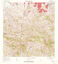
 1957 Corozal1960 Print · USGSThe interior highlands of Puerto Rico are captured here during a period of significant rural development. Genealogists can locate family-named barrios like Ortiz and Medina, or trace local history at the Iglesia La Milagrosa and Escuela Ramón Pabón.2 unique versions available
 - 1957 Map of Comerio, 1960 Print
 1957 Comerio1960 Print · USGSThe central mountains of Puerto Rico are captured here in the late fifties, showing the relationship between steep-slope agriculture and growing urban centers. Researchers can trace family roots through numerous schools and barrios, from Escuela Segunda Unidad de Palomas to the hills of Sumidero.5 unique versions available
 - 1957 Map of Barranquitas, 1960 Print
 1957 Barranquitas1960 Print · USGSThe central mountains of Puerto Rico are shown here in the mid-fifties, featuring a dense network of rural schools and traditional barrios. Genealogists and historians can trace family roots through the numerous school districts and settlements like Helechal, Hacienda Ortega, and Robles.5 unique versions available
 - 1963 Map of Naranjito, 1965 Print
 1963 Naranjito1965 Print · USGSNaranjito and the Puerto Rican interior are shown here during a period of rapid development in the 1960s. Researchers can trace rural school locations like Escuela Dajaos Sexto or explore the early power network at Planta Hidroeléctrica Comerío No 2.
 - 1969 Map of Naranjito, 1972 Print
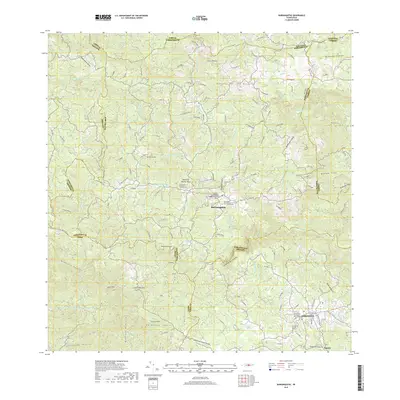
 1969 Naranjito1972 Print · USGSThe Naranjito and Bayamón regions undergo significant growth in the late sixties as residential developments meet industrial river infrastructure. Researchers can trace the development of Royal Town or locate the Planta Hidroeléctrica Comerio Num 1 and Escuela Miguel Cervantes Saavedra.3 unique versions available
 - 1972 Map of Corozal, 1974 Print
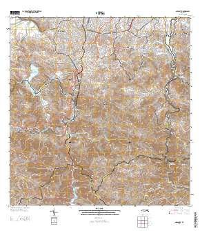
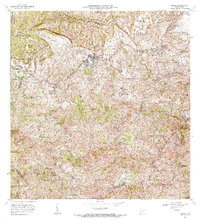 1972 Corozal1974 Print · USGSIn the early seventies, the central highlands of Puerto Rico around Corozal featured a vibrant network of rural barrios and agricultural stations. Genealogists can trace family footprints in settlements like Ramón Pabón or locate several local schools such as Escuela Virgilio Morales.3 unique versions available
 - 2013 Map of Comerio, 2013 Print
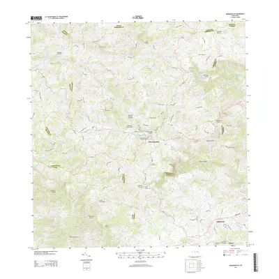
 2013 Comerio2013 Print · USGSCovers Doña Elena, including Cidra, Comerío, and other nearby areas
 - 2013 Map of Barranquitas, 2013 Print
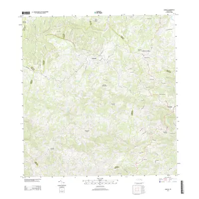
 2013 Barranquitas2013 Print · USGSCovers Doña Elena, including Aibonito, Barranquitas, and other nearby areas
 - 2013 Map of Naranjito, 2013 Print
 2013 Naranjito2013 Print · USGSCovers Doña Elena, including Naranjito, Villas del Olimpo, and other nearby areas
 - 2013 Map of Corozal, 2013 Print
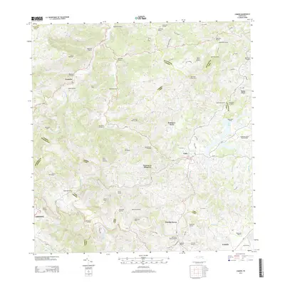
 2013 Corozal2013 Print · USGSCovers Doña Elena, including Corozal, Benito Nieves (Los Quiles), and other nearby areas
 - 2018 Map of Barranquitas, 2018 Print
 2018 Barranquitas2018 Print · USGSCovers Doña Elena, including Aibonito, Barranquitas, and other nearby areas
 - 2018 Map of Comerio, 2018 Print
 2018 Comerio2018 Print · USGSCovers Doña Elena, including Cidra, Comerío, and other nearby areas
Showing maps 1-25 of 31
Frequently asked questions
- What are the different types of historical maps available for Doña Elena?
- What is the oldest map of Doña Elena?
- Where can I purchase historical maps of Doña Elena for my home or office?
- Where can I download high-res historical maps of Doña Elena?
- Are there historical topographic maps available for Doña Elena?
- Is there historical aerial imagery available for Doña Elena?
- Where are historical maps of Doña Elena sourced from?