Old Maps of Candelero Abajo, Humacao for Metal Detecting
Plan your next treasure hunt with 8 historic maps of Candelero Abajo. Find old homesites, ghost towns, trails, and gathering spots that may be lost to time — perfect for identifying promising metal detecting locations.
- Locate forgotten sites: Uncover places like long-lost settlements, abandoned rail lines, or gathering spots.
- Plan better hunts: Use map overlays combined with LiDAR or satellite views to narrow in on historically rich areas.
- Made for detectorists: Thousands of hobbyists use these maps to discover relics, coins, and hidden history.
Use these historic maps to boost your research and find new opportunities beneath the surface of Candelero Abajo.
Candelero Abajo, Humacao maps
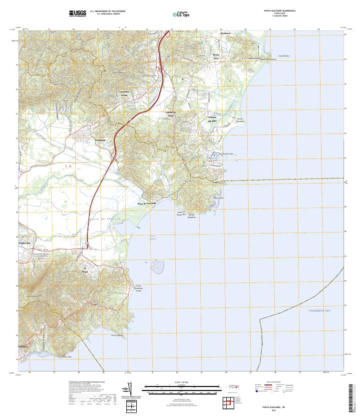
(8)- 1946 Map of Punta Guayanes
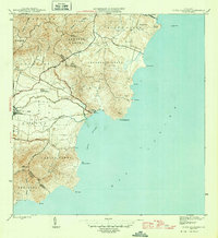 1946 Punta Guayanes1946 Print · USGSThe coastal sugar and rail landscape of eastern Puerto Rico is captured here in the mid-1940s. Genealogists and historians can trace the industrial footprint of Central Roig and find old settlements like Colonia Monserrate and Playa de Guayanes.3 unique versions available
 - 1947 Map of Punta Guayanes NE
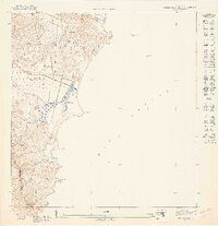 1947 Punta Guayanes NE1947 Print · USGSCoastal Humacao and the Yabucoa border are captured here just after the war, showing a landscape of coastal marshes and isolated estates. Trace early property footprints in Buena Vista or study the shoreline near Pta Candelero and Morro de Humacao.
 - 1947 Map of Punta Guayanes NO
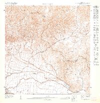 1947 Punta Guayanes NO1947 Print · USGSCoastal Yabucoa and the surrounding valleys are captured here in the late Forties, showing a landscape defined by the sugar industry. Researchers can trace the narrow-gauge Central Roig railroad and locate old settlements like Colonia Monserrate.
 - 1952 Map of Punta Guayanes, 1953 Print
 1952 Punta Guayanes1953 Print · USGSSoutheast Puerto Rico’s coastline in the early fifties shows a vibrant agricultural and maritime landscape centered around the sugar industry. Genealogists and historians can trace family locations in Colonia Monserrate, Playa de Guayanes, and near the industrial site of Central Roig.2 unique versions available
 - 1960 Map of Punta Guayanes, 1962 Print
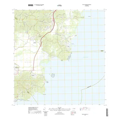
 1960 Punta Guayanes1962 Print · USGSThe Yabucoa coastline in the early sixties reveals a landscape shaped by sugar production and rural commerce. Genealogists and historians can locate former schools like Escuela Asunción Lopez and trace the sugar infrastructure of Central Roig.6 unique versions available
 - 2013 Map of Punta Guayanes, 2013 Print
 2013 Punta Guayanes2013 Print · USGSCovers Candelero Abajo, including Palladio, Sector Los Colones, and other nearby areas
 - 2018 Map of Punta Guayanes, 2018 Print
 2018 Punta Guayanes2018 Print · USGSCovers Candelero Abajo, including Palladio, Sector Los Colones, and other nearby areas
 - 2024 Map of Punta Guayanes, 2024 Print
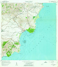
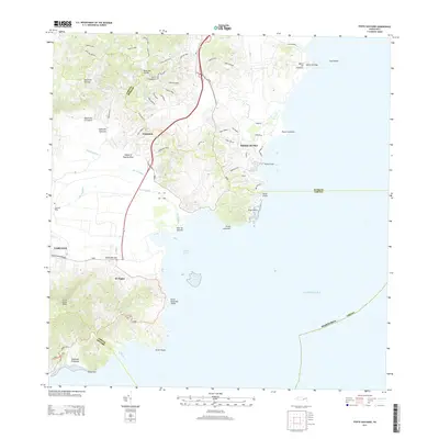
 2024 Punta Guayanes2024 Print · USGSThe Yabucoa coast and fertile valley are documented here during a period of modern development and educational growth. Researchers can trace the coastal landscape from Palmas del Mar to Puerto Yabucoa or locate inland sites like El Negro.
End of results
Showing maps 1-8 of 8
Frequently asked questions
- What are the different types of historical maps available for Candelero Abajo?
- What is the oldest map of Candelero Abajo?
- Where can I purchase historical maps of Candelero Abajo for my home or office?
- Where can I download high-res historical maps of Candelero Abajo?
- Are there historical topographic maps available for Candelero Abajo?
- Is there historical aerial imagery available for Candelero Abajo?
- Where are historical maps of Candelero Abajo sourced from?