Old Maps of Punta Santiago, Humacao for Academic Research
Study the evolution of Punta Santiago with 15 high-resolution historic maps. Whether you're teaching, researching, or modeling changes in land use, these maps provide essential visual documentation of urban, environmental, and geographic change.
- Analyze long-term change: Track patterns in development, transportation, and natural features.
- Ideal for environmental or urban studies: Support academic projects with primary historical map data.
- Use in the classroom or lab: Educators and researchers rely on these maps to bring historical context to life.
These maps are a powerful tool for teaching, research, and visualizing how Punta Santiago has changed over the decades.
Punta Santiago, Humacao maps
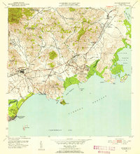
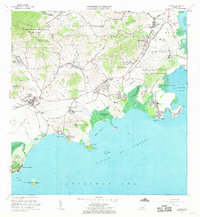
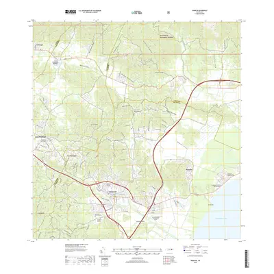
(15)- 1946 Map of Humacao
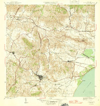 1946 Humacao1946 Print · USGSCoastal Puerto Rico in the mid-forties was a landscape defined by the sugar industry and its specialized rail networks. Genealogists and historians can trace the worker colonias and railroads like the Ferrocarril de Pasto Viejo and Central Ejemplo.4 unique versions available
 - 1946 Map of Naguabo
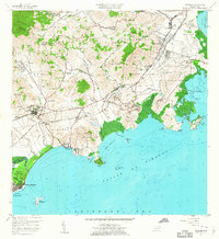
 1946 Naguabo1946 Print · USGSEastern Puerto Rico in the mid-forties reveals a landscape shaped by sugar plantation rail lines and coastal navigation. Genealogists can trace family connections to industrial sites like Colonia San Cristóbal or the coastal village of Shanghai.4 unique versions available
 - 1947 Map of Humacao SE
 1947 Humacao SE1947 Print · USGSSoutheastern Puerto Rico appears here during the mid-forties, showing a landscape shaped by coastal sugar production and rail transport. Genealogists and researchers can trace the locations of family-named agricultural sites like Colonia Mayo, Colonia Santa Teresa, and the rail junction at Pueblito de los Perros.
 - 1952 Map of Humacao, 1953 Print
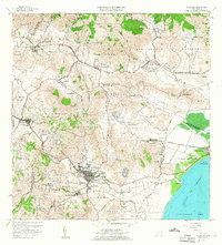
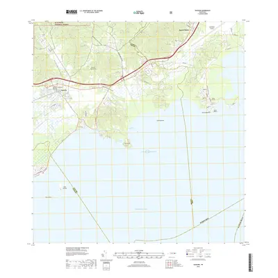
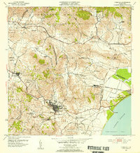 1952 Humacao1953 Print · USGSSoutheast Puerto Rico in the early fifties shows a bustling agricultural landscape defined by the sugar industry and coastal rail. Genealogists and historians can locate numerous workforce settlements and family-named landmarks like Central El Ejemplo, Colonia Santa Teresa, and Pueblito del Rio.2 unique versions available
 - 1952 Map of Naguabo, 1953 Print
 1952 Naguabo1953 Print · USGSIn the early fifties, eastern Puerto Rico was a landscape of coastal military outposts and sugar colonies. Researchers can trace the FERROCARRILES DEL ESTE rail line as it connects Naguabo to rural centers like Hacienda Grande and Fort Bundy.2 unique versions available
 - 1957 Map of Naguabo, 1960 Print
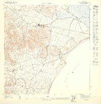
 1957 Naguabo1960 Print · USGSCoastal Puerto Rico in the late fifties shows a landscape of military expansion and sugar rail networks. Genealogists and historians can locate family landmarks like Escuela Mariana and Hacienda Grande, or trace the tracks of the Fajardo Eastern Sugar Associates.
 - 1958 Map of Humacao, 1960 Print
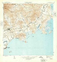
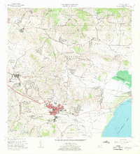
 1958 Humacao1960 Print · USGSSoutheastern Puerto Rico is mapped here in the late fifties, showing the coastal sugar economy and mountain utility developments. Trace family roots in Humacao neighborhoods or find rural landmarks like Central El Ejemplo and the Planta Hidroeléctrica de Río Blanco.
 - 1967 Map of Humacao, 1969 Print
 1967 Humacao1969 Print · USGSSoutheast Puerto Rico during the late sixties shows a landscape of growing towns and industrial sites near the coast. Genealogists can locate numerous local schools like Escuela Dra Isidra Vidal and trace historical transport lines like the Via del Ferrocarril.3 unique versions available
 - 1967 Map of Naguabo, 1970 Print
 1967 Naguabo1970 Print · USGSThe eastern coast of Puerto Rico is shown here in the late sixties, balancing military expansion with local rural life. Researchers can trace the layout of the Roosevelt Roads Naval Reservation and locate sites like Estación Botija or Fort Bundy.3 unique versions available
 - 2013 Map of Naguabo, 2013 Print
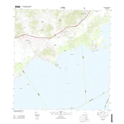 2013 Naguabo2013 Print · USGSCovers Punta Santiago, including Naguabo, Estación Botija, and other nearby areas
 - 2013 Map of Humacao, 2013 Print
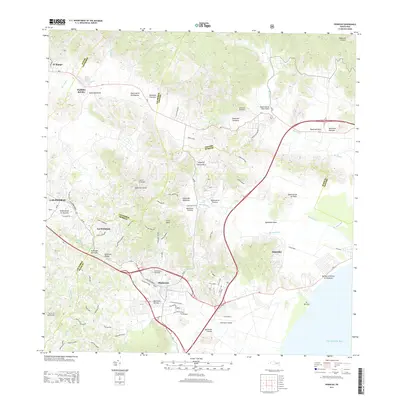 2013 Humacao2013 Print · USGSCovers Punta Santiago, including Humacao, Las Piedras, and other nearby areas
 - 2018 Map of Naguabo, 2018 Print
 2018 Naguabo2018 Print · USGSCovers Punta Santiago, including Naguabo, Estación Botija, and other nearby areas
 - 2018 Map of Humacao, 2018 Print
 2018 Humacao2018 Print · USGSCovers Punta Santiago, including Humacao, Las Piedras, and other nearby areas
 - 2024 Map of Naguabo, 2024 Print
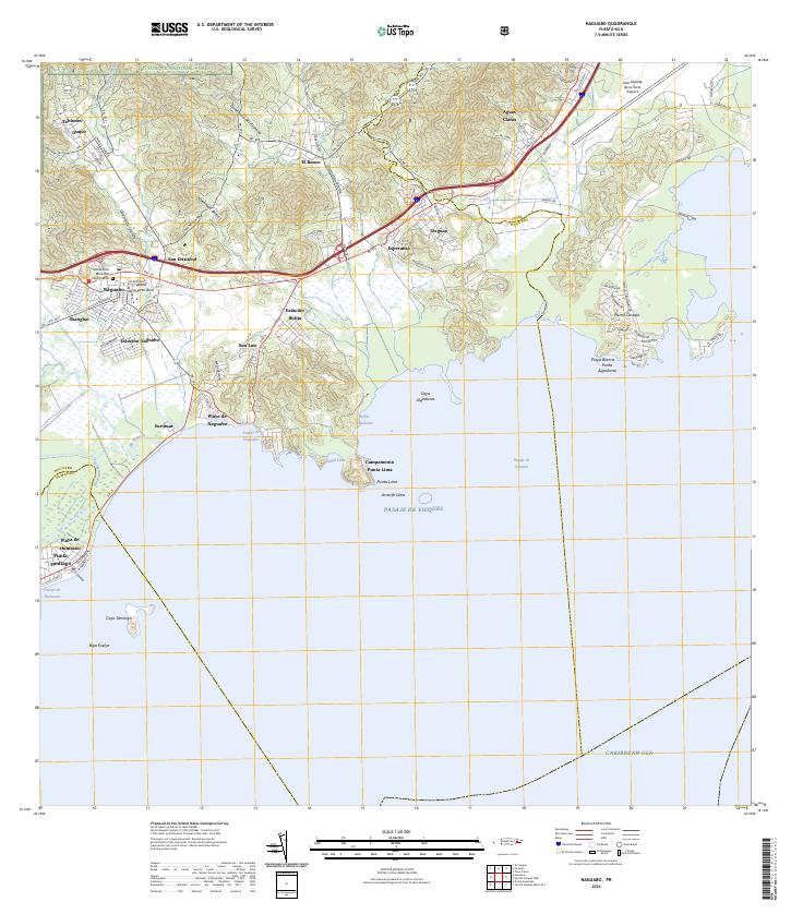 2024 Naguabo2024 Print · USGSThe eastern coast of Puerto Rico is captured here as it meets the Caribbean, showing the interface between the rainforest and the sea. Researchers can trace local history through sites like Viejo Pueblo, the Cementerio Municipal, and the coastal Campamento Punta Lima.
 - 2024 Map of Humacao, 2024 Print
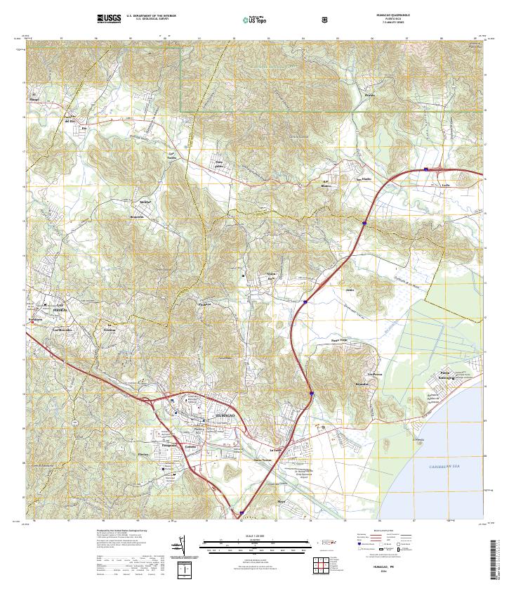 2024 Humacao2024 Print · USGSEastern Puerto Rico’s diverse terrain, from the Luquillo Mountains to the Caribbean coast, is documented in this contemporary survey. Researchers can trace local heritage through the Cementerio Municipal Humacao, the streets of Las Piedras, and the coastal reaches of Punta Santiago.
End of results
Showing maps 1-15 of 15
Frequently asked questions
- What are the different types of historical maps available for Punta Santiago?
- What is the oldest map of Punta Santiago?
- Where can I purchase historical maps of Punta Santiago for my home or office?
- Where can I download high-res historical maps of Punta Santiago?
- Are there historical topographic maps available for Punta Santiago?
- Is there historical aerial imagery available for Punta Santiago?
- Where are historical maps of Punta Santiago sourced from?