Old Maps of Buenos Aires, Lares for Genealogy
Trace your family roots with 11 historic maps of Buenos Aires. These high-res maps reveal old neighborhoods, homesites, landmarks, and streets — helping you uncover where your ancestors lived and how the area evolved over time.
- Explore historic neighborhoods: Identify where your relatives may have lived in the 1800s or 1900s.
- Compare maps over time: Trace the changes in streets, buildings, and landmarks for multi-generational research.
- Perfect for genealogy & ancestry research: Used by family historians and researchers to map out lineage and migration.
These maps are an incredible resource for exploring your personal connection to Buenos Aires's past.
Buenos Aires, Lares maps
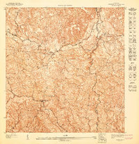
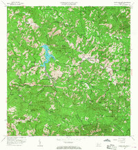
(11)- 1938 Map of San Sebastian
 1938 San Sebastian1938 Print · USGSCovers Buenos Aires, including San Sebastián, Lares, and other nearby areas
 - 1941 Map of San Sebastian
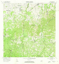
 1941 San Sebastian1941 Print · USGSCovers Buenos Aires, including San Sebastián, Lares, and other nearby areas4 unique versions available
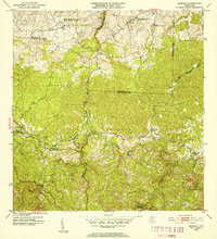
 - 1946 Map of Bayaney
 1946 Bayaney1946 Print · USGSCovers Buenos Aires, including Sector El Calvario, Parcelas Miria, and other nearby areas3 unique versions available
 - 1946 Map of Monte Guilarte
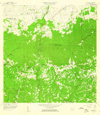
 1946 Monte Guilarte1946 Print · USGSCovers Buenos Aires, including Sector Los Pagán, Sector Palo Seco, and other nearby areas3 unique versions available
 - 1947 Map of Bayaney SO
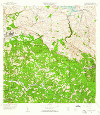
 1947 Bayaney SO1947 Print · USGSCovers Buenos Aires, including Parcelas Miria, Utuado, and other nearby areas
 - 1952 Map of Bayaney
 1952 Bayaney1952 Print · USGSCovers Buenos Aires, including Sector El Calvario, Parcelas Miria, and other nearby areas
 - 1952 Map of Monte Guilarte, 1953 Print
 1952 Monte Guilarte1953 Print · USGSCovers Buenos Aires, including Sector Los Pagán, Sector Palo Seco, and other nearby areas
 - 1957 Map of Bayaney, 1960 Print
 1957 Bayaney1960 Print · USGSCovers Buenos Aires, including Sector El Calvario, Parcelas Miria, and other nearby areas2 unique versions available
 - 1958 Map of San Sebastian, 1960 Print
 1958 San Sebastian1960 Print · USGSCovers Buenos Aires, including San Sebastián, Lares, and other nearby areas3 unique versions available
 - 1960 Map of Monte Guilarte, 1968 Print
 1960 Monte Guilarte1968 Print · USGSCovers Buenos Aires, including Sector Los Pagán, Sector Palo Seco, and other nearby areas3 unique versions available
 - 1970 Map of Bayaney, 1973 Print
 1970 Bayaney1973 Print · USGSCovers Buenos Aires, including Sector El Calvario, Parcelas Miria, and other nearby areas3 unique versions available
End of results
Showing maps 1-11 of 11
Frequently asked questions
- What are the different types of historical maps available for Buenos Aires?
- What is the oldest map of Buenos Aires?
- Where can I purchase historical maps of Buenos Aires for my home or office?
- Where can I download high-res historical maps of Buenos Aires?
- Are there historical topographic maps available for Buenos Aires?
- Is there historical aerial imagery available for Buenos Aires?
- Where are historical maps of Buenos Aires sourced from?