Old Maps of El Ceiba, Loíza for Metal Detecting
Plan your next treasure hunt with 8 historic maps of El Ceiba. Find old homesites, ghost towns, trails, and gathering spots that may be lost to time — perfect for identifying promising metal detecting locations.
- Locate forgotten sites: Uncover places like long-lost settlements, abandoned rail lines, or gathering spots.
- Plan better hunts: Use map overlays combined with LiDAR or satellite views to narrow in on historically rich areas.
- Made for detectorists: Thousands of hobbyists use these maps to discover relics, coins, and hidden history.
Use these historic maps to boost your research and find new opportunities beneath the surface of El Ceiba.
El Ceiba, Loíza maps
(8)- 1941 Map of Rio Grande
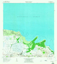
 1941 Rio Grande1941 Print · USGSCoastal Puerto Rico in the early 1940s reveals a landscape of tidal marshes and agricultural estates. Genealogists and researchers can trace family lands through the numerous named colonias like Colonia Blasini and Colonia Dolores, or locate early settlements such as Poblado Honduras.2 unique versions available
 - 1947 Map of Rio Grande
 1947 Rio Grande1947 Print · USGSThe northeastern coast of Puerto Rico is captured here in the mid-1940s, highlighting a landscape defined by river deltas and sugar colonias. Genealogists and historians can trace family locations in settlements like Poblado Honduras and Colonia Fortuna.3 unique versions available
 - 1949 Map of Rio Grande SO
 1949 Rio Grande SO1949 Print · USGSNortheast Puerto Rico is shown here in the late 1940s, where the coastal plains meet the mouths of major river systems. Genealogists and historians can trace the family-named agriculture centers like Colonia Mimi and early settlements such as Poblado Honduras.
 - 1956 Map of Rio Grande, 1958 Print
 1956 Rio Grande1958 Print · USGSCoastal Puerto Rico comes to life in the 1950s, showing a landscape of sugar-era settlements and river deltas. Genealogists can locate specific homesteads at Poblado Honduras or trace community roots at Colonia Dolores and Comunidad Dolores.
 - 1963 Map of Rio Grande, 1965 Print
 1963 Rio Grande1965 Print · USGSCoastal Puerto Rico in the early sixties shows a landscape of growing barrios and winding rivers before modern development. Genealogists and historians can trace family roots in settlements like Suárez and Mini Mini or locate the Escuela Luis Calderón.4 unique versions available
 - 2013 Map of Rio Grande, 2013 Print
 2013 Rio Grande2013 Print · USGSCovers El Ceiba, including Río Grande, Lindo Mar, and other nearby areas
 - 2018 Map of Rio Grande, 2018 Print
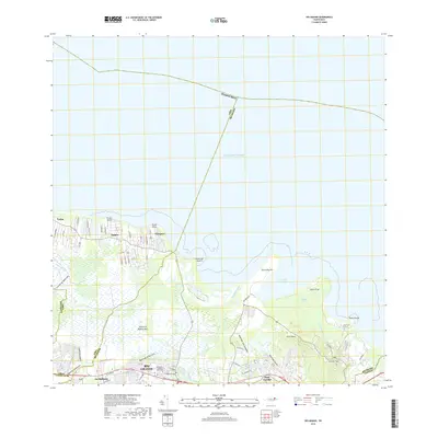 2018 Rio Grande2018 Print · USGSCovers El Ceiba, including Río Grande, Lindo Mar, and other nearby areas
 - 2024 Map of Rio Grande, 2024 Print
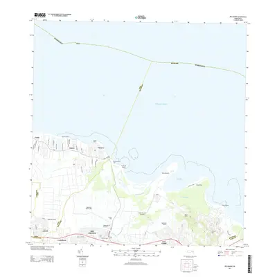
 2024 Rio Grande2024 Print · USGSCoastal Puerto Rico comes alive in this contemporary survey of the area between the Atlantic and the northern foothills. Trace the development of Río Grande and its outlying barrios, from the riverside community of Blasina to the heights of Cerro El Faro.
End of results
Showing maps 1-8 of 8
Frequently asked questions
- What are the different types of historical maps available for El Ceiba?
- What is the oldest map of El Ceiba?
- Where can I purchase historical maps of El Ceiba for my home or office?
- Where can I download high-res historical maps of El Ceiba?
- Are there historical topographic maps available for El Ceiba?
- Is there historical aerial imagery available for El Ceiba?
- Where are historical maps of El Ceiba sourced from?